It was a bright, sunny Mother’s Day midday, but also very windy, and we’ve done a lot of the really local little hikes. So, we decided to take a drive this afternoon instead, something we’ve been talking about for a couple weeks now, up into the Western Mountains region of Maine.
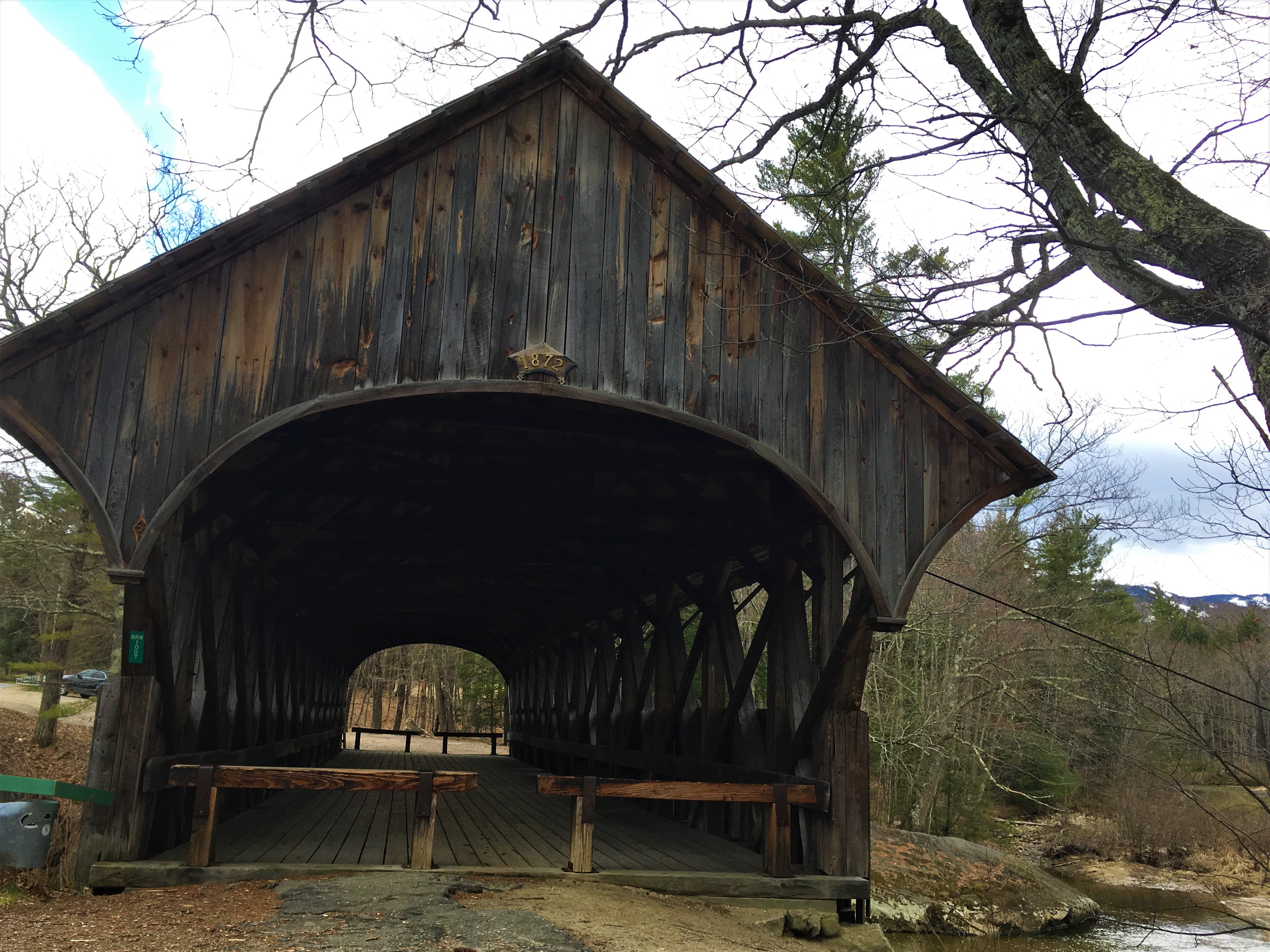
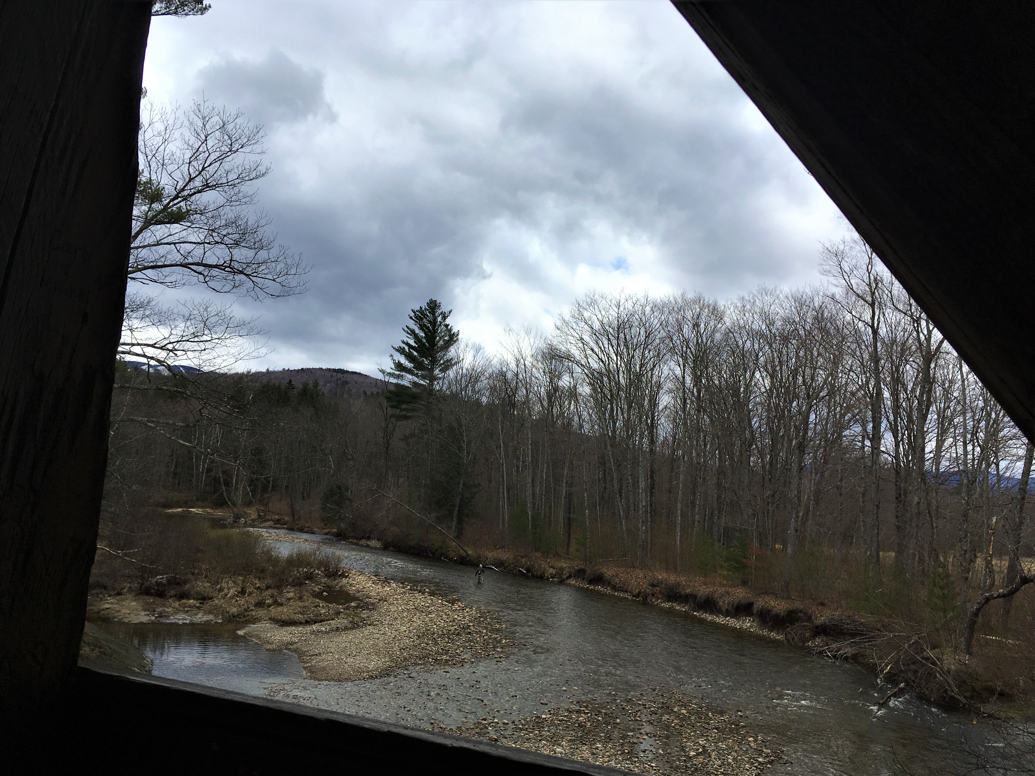
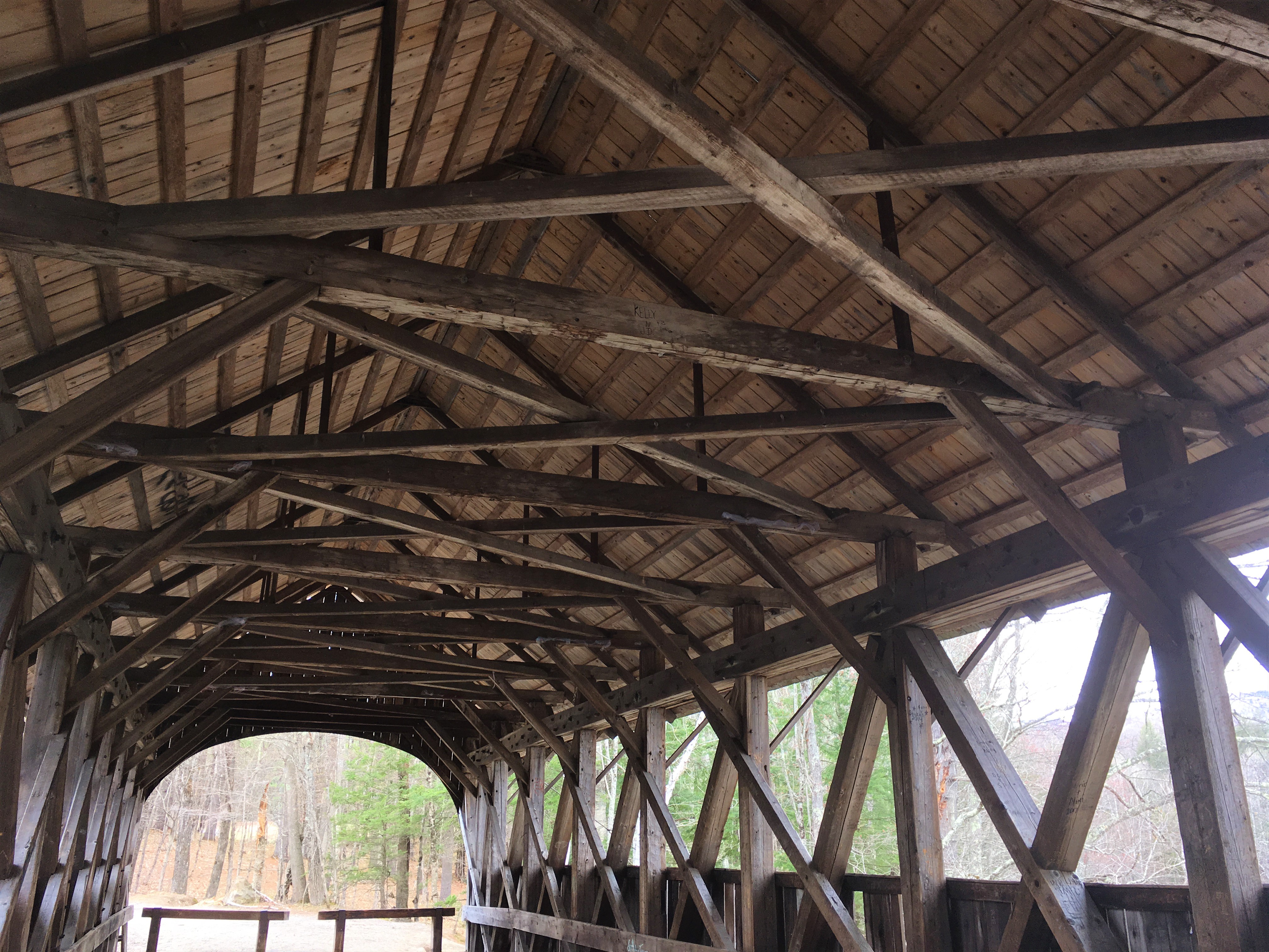
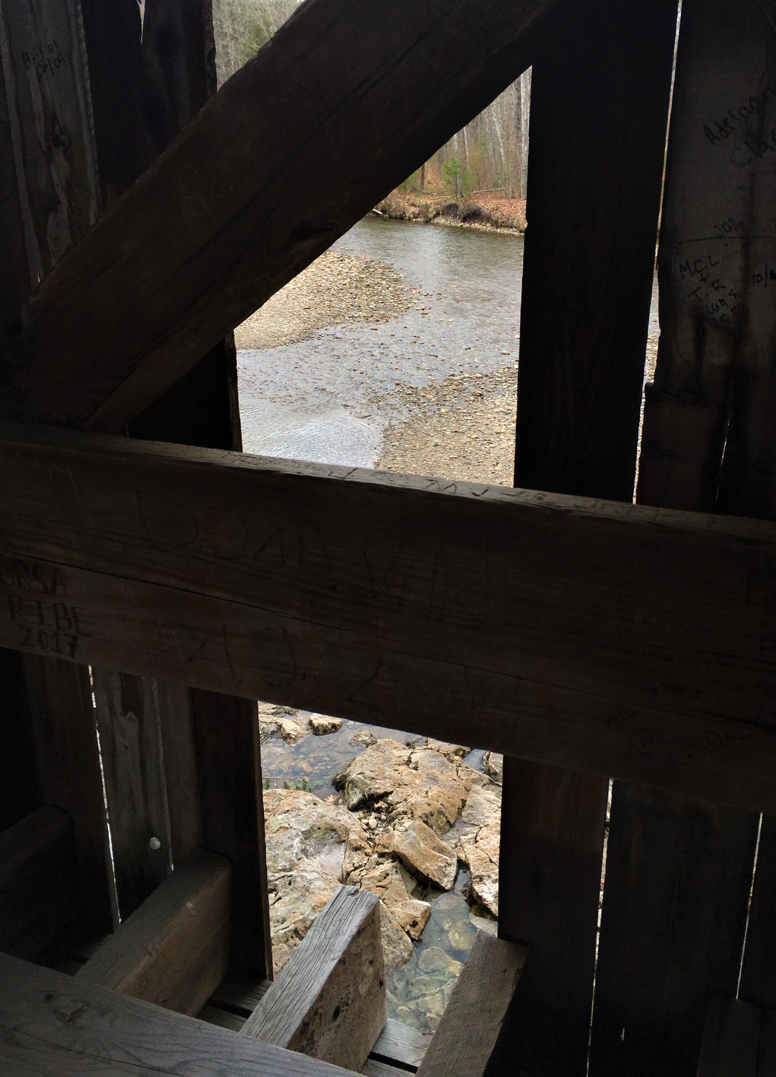
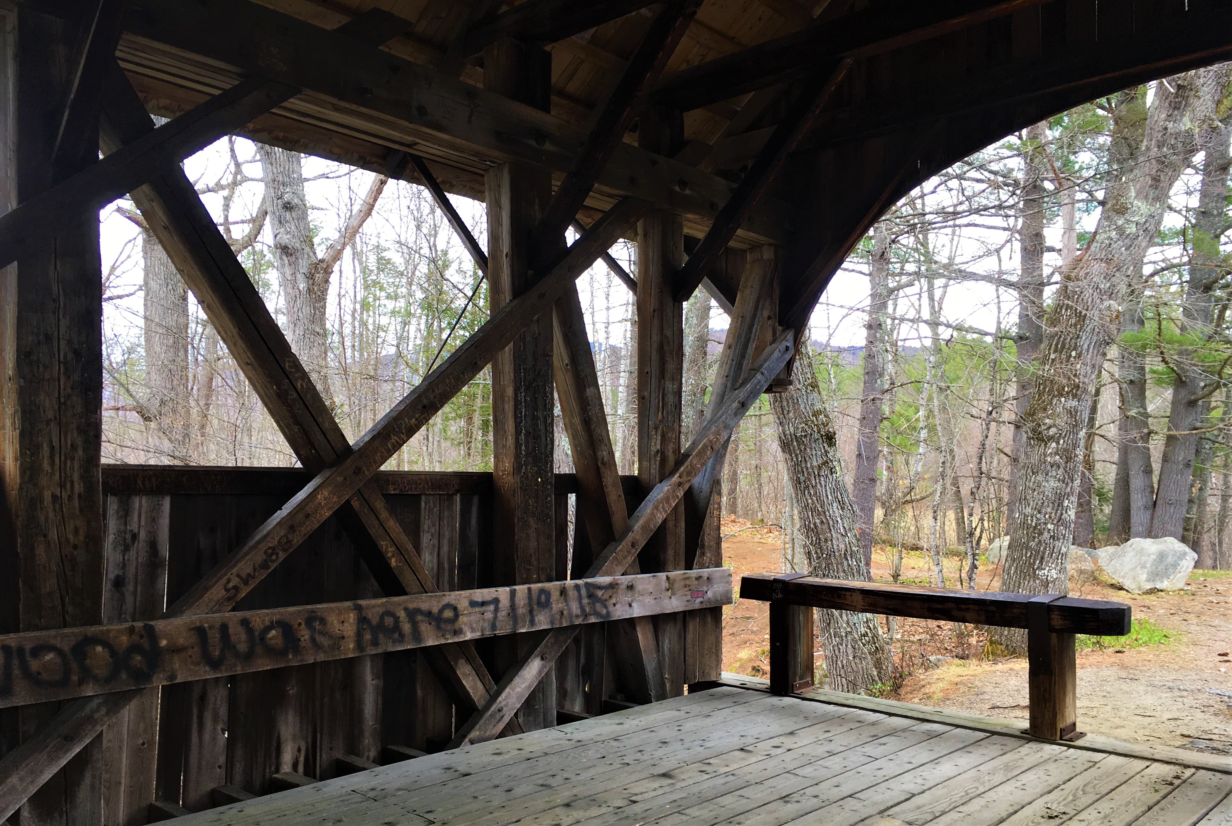
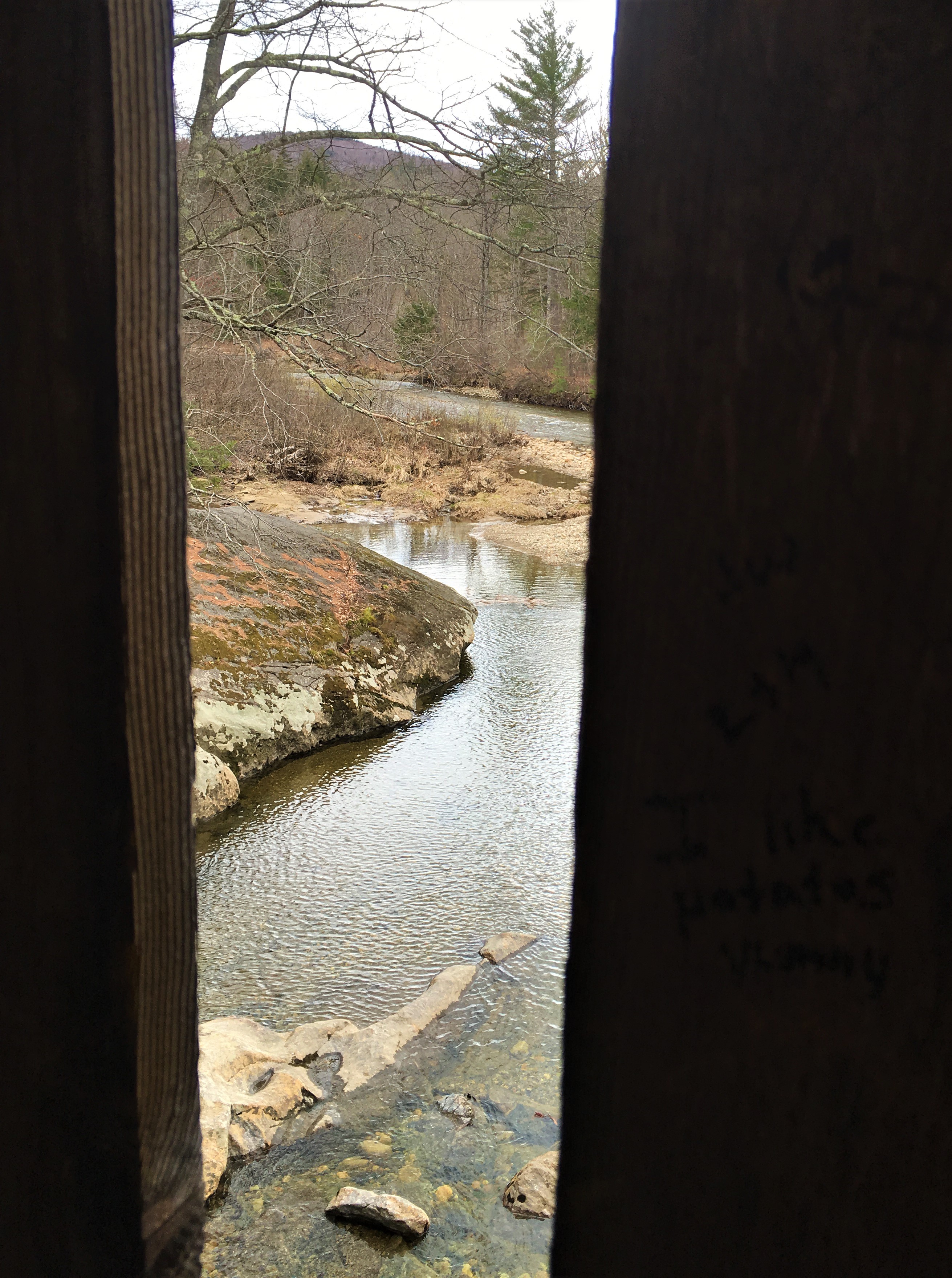
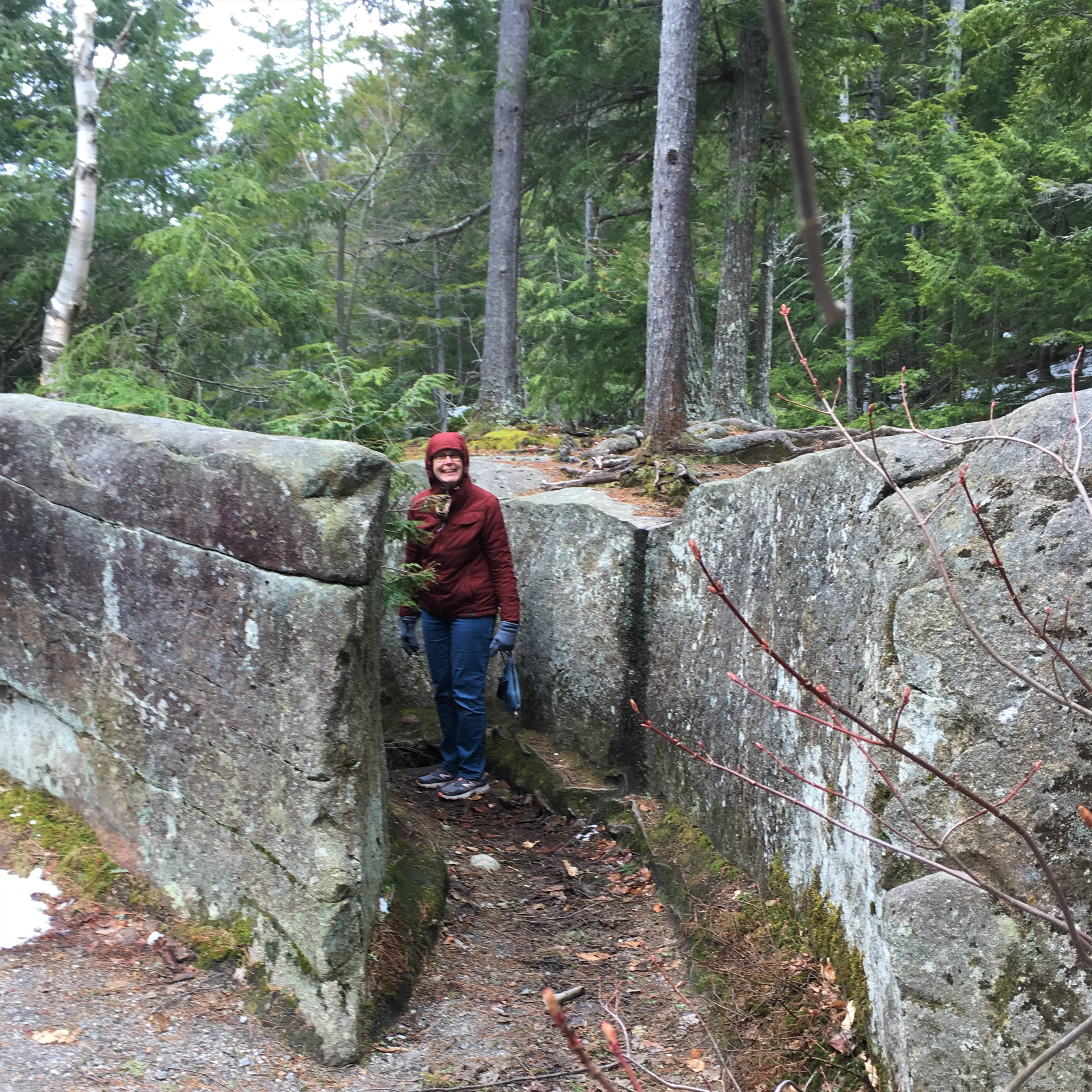
Sunday River Bridge
First, Dad wanted to swing by Sunday River and see how many of the ski trails still had snow on them, even though the slopes were closed due to pandemic almost two months ago. There was still some snow, and we saw a few hikers on foot, but the huge parking lots were empty. (We would swing past Wildcat on the way home and see the same.)
Swinging by Sunday River ski area also meant swinging by Sunday River Brewing Company, whose dining room was clearly empty despite losing their liquor license and Department of Health license for defying the governor‘s stay at home orders. We’ll never eat there again!
But we were quite excited about our next find! Although it’s actually in Newry, the next town over, we were delighted to stumble upon the Sunday River Bridge along our way.
Screw Auger Falls
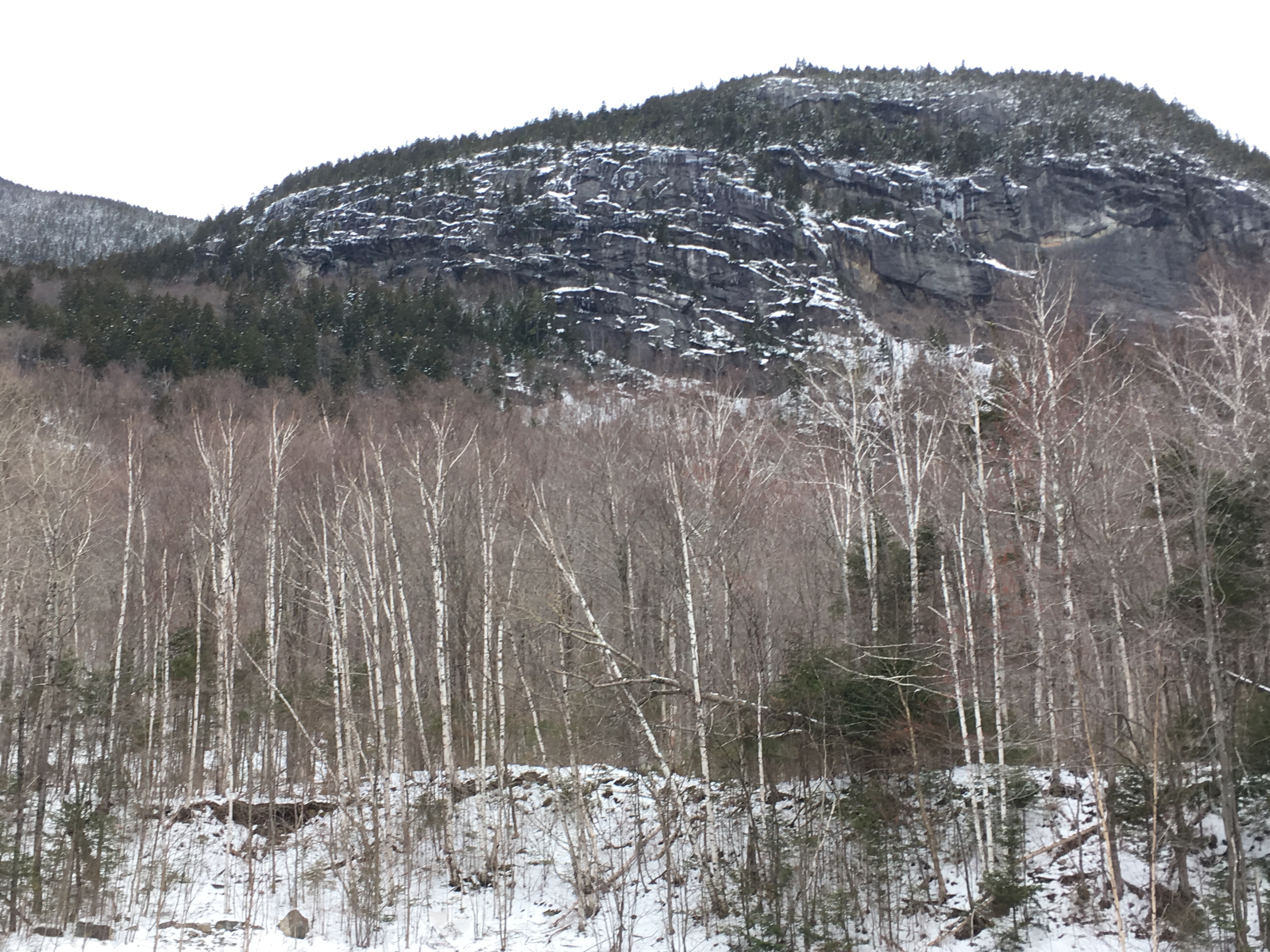
There were flurries in the air by the time we reached Grafton Notch State Park and the turn-off into Screw Auger Falls, and a few people in the parking lot, but no many that it made us nervous.
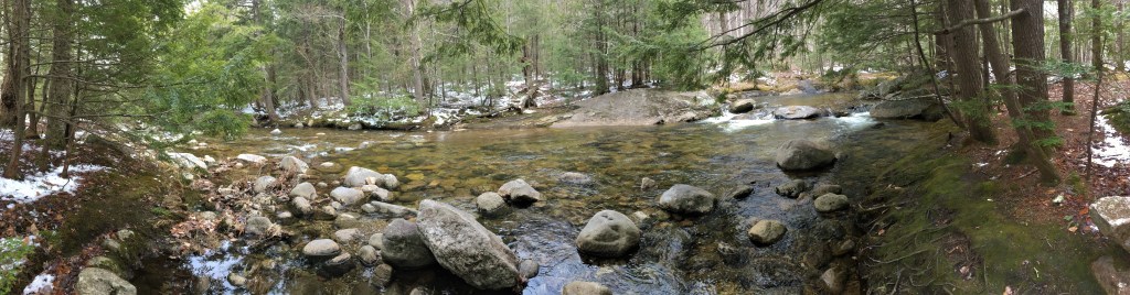
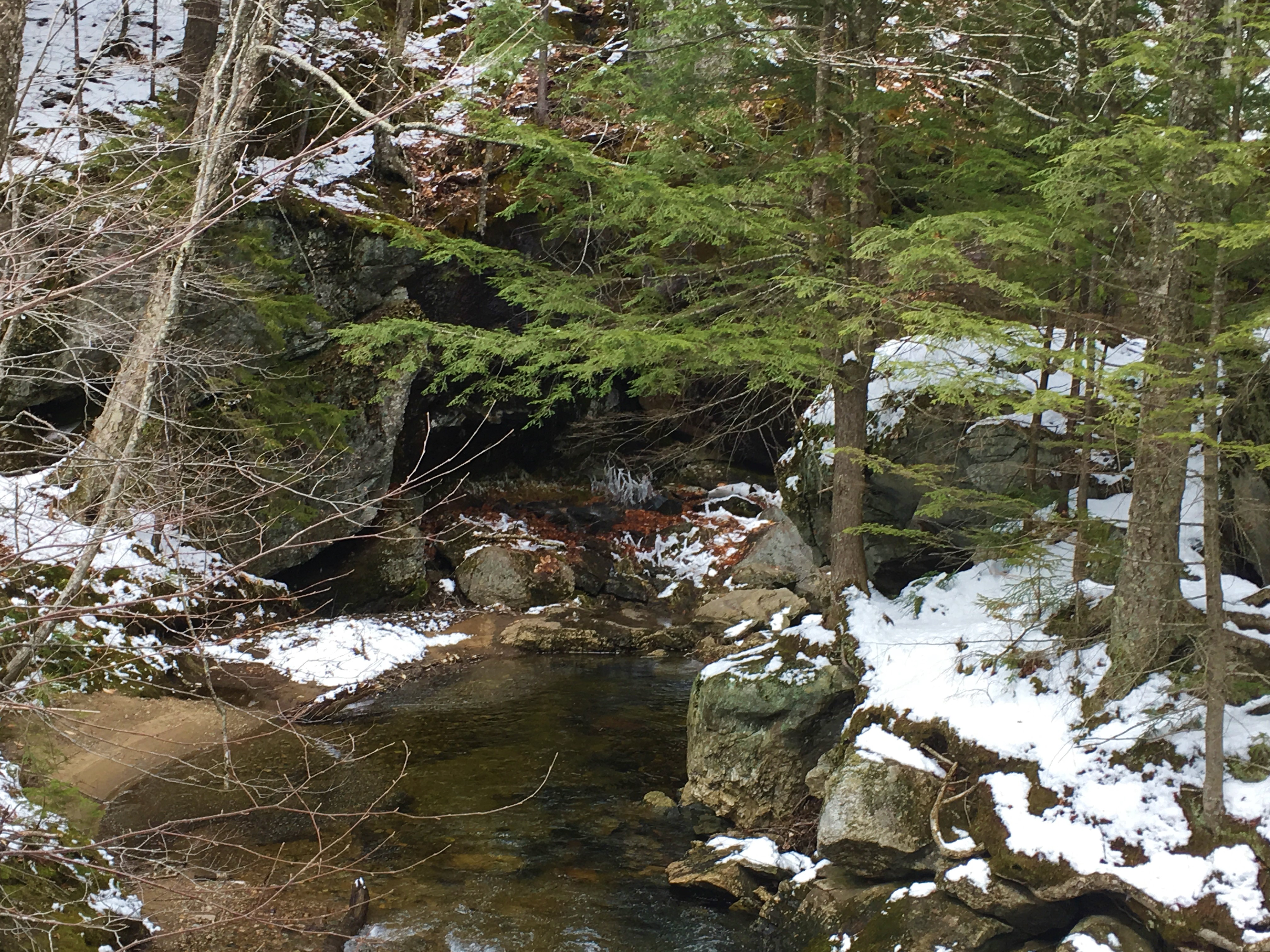
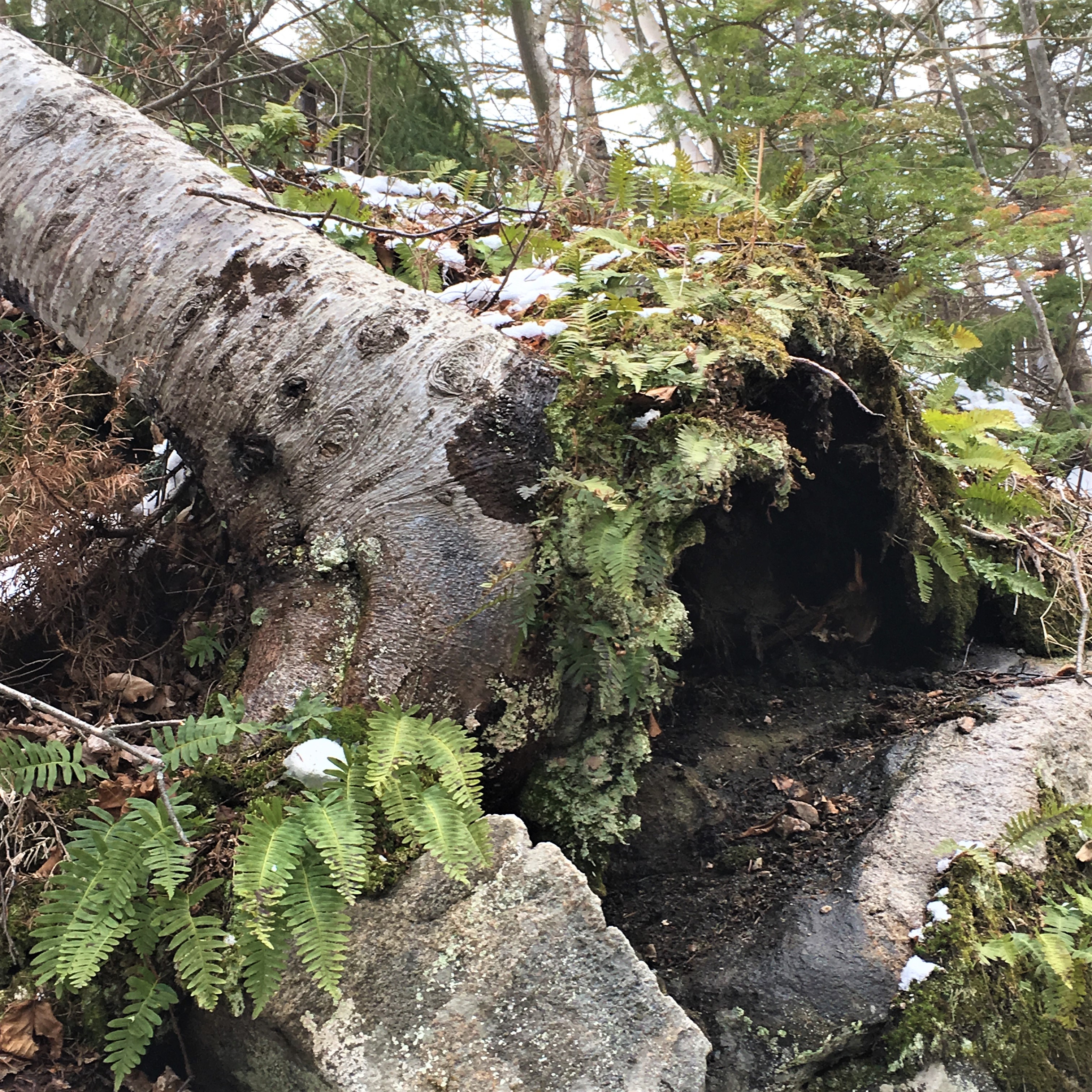
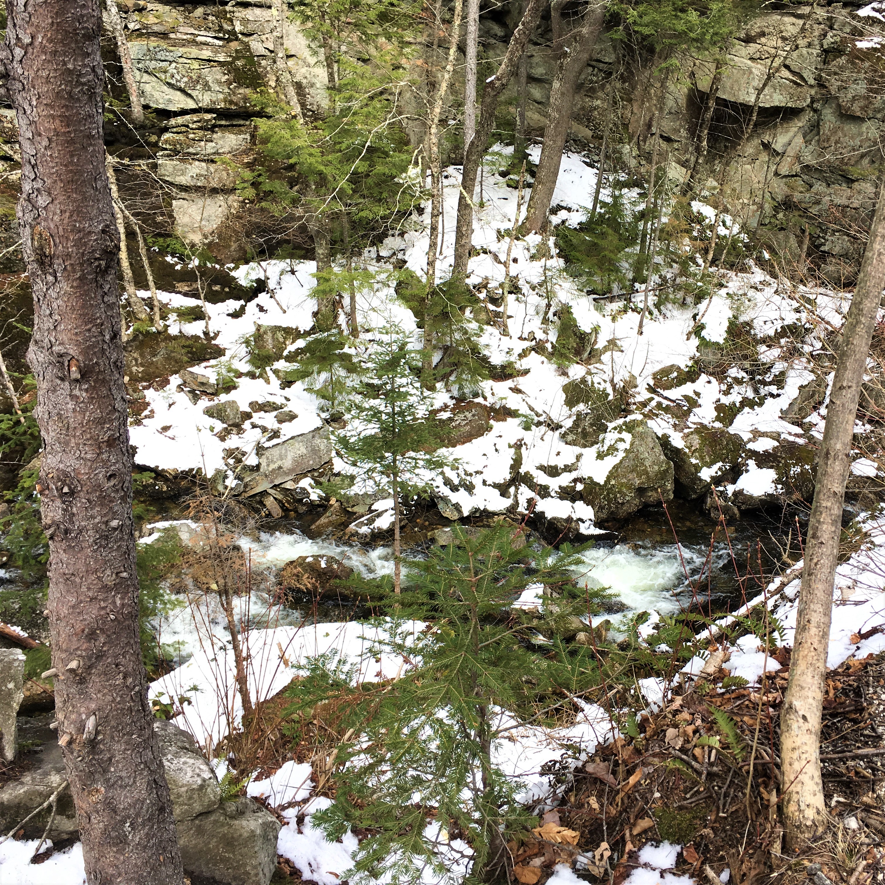
The first bit is an array of picnic areas along a shallow river cascading down a series of small waterfalls. It was quite lovely, with the last night’s snow spread across the moss- and leaf-strewn open ground beneath the trees.
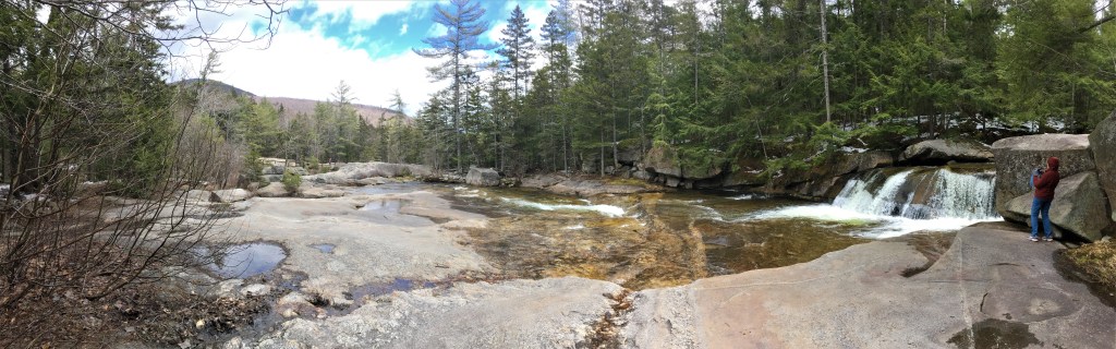


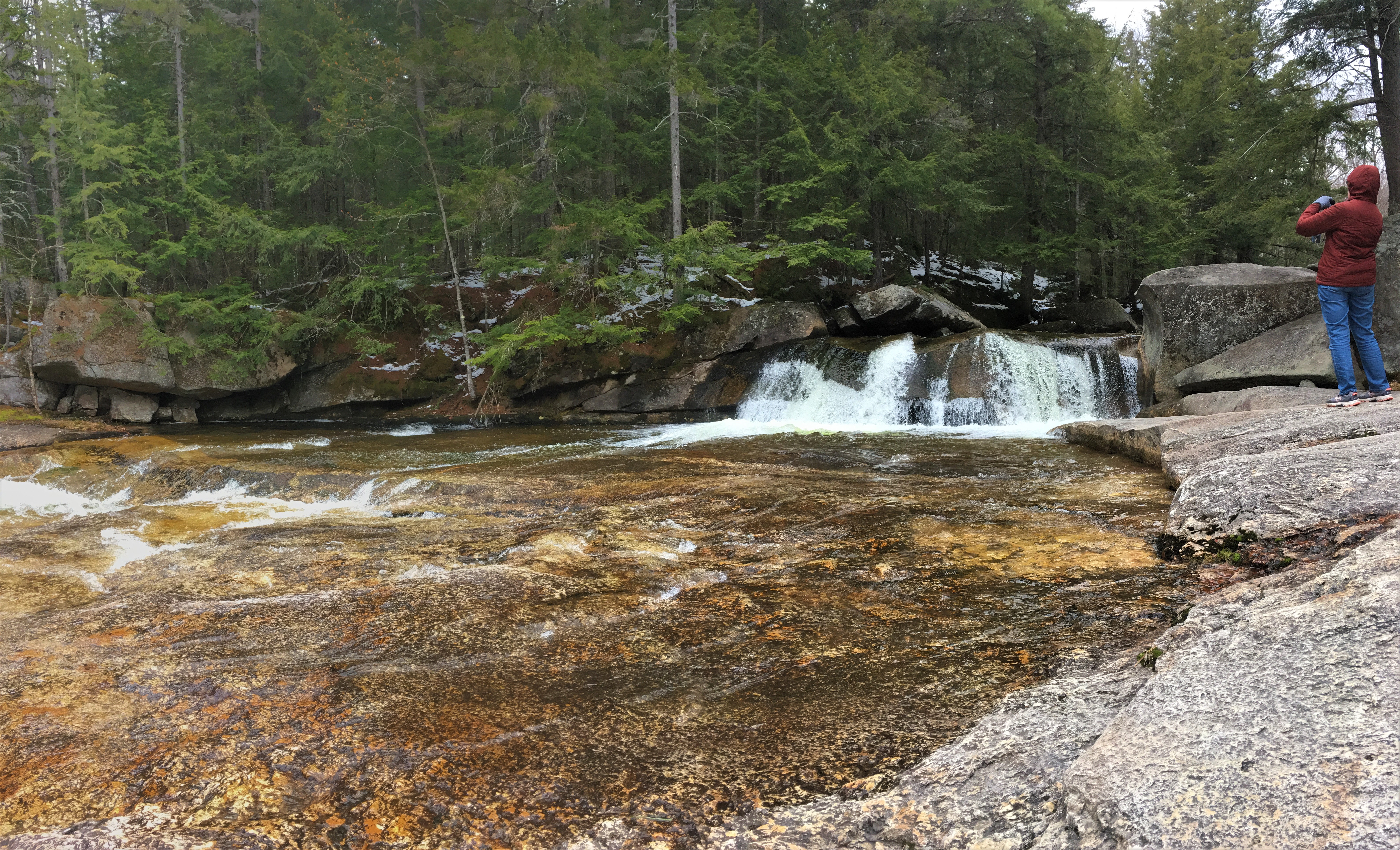
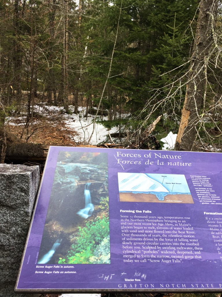
Then, as you turn a corner, suddenly the granite drops off dramatically with these rushing falls of water, and you begin to see how the site got the name “Screw Auger” Falls, the result of swirling glacial meltwater, merging together over centuries into a narrow gorge of artfully scalloped walls.
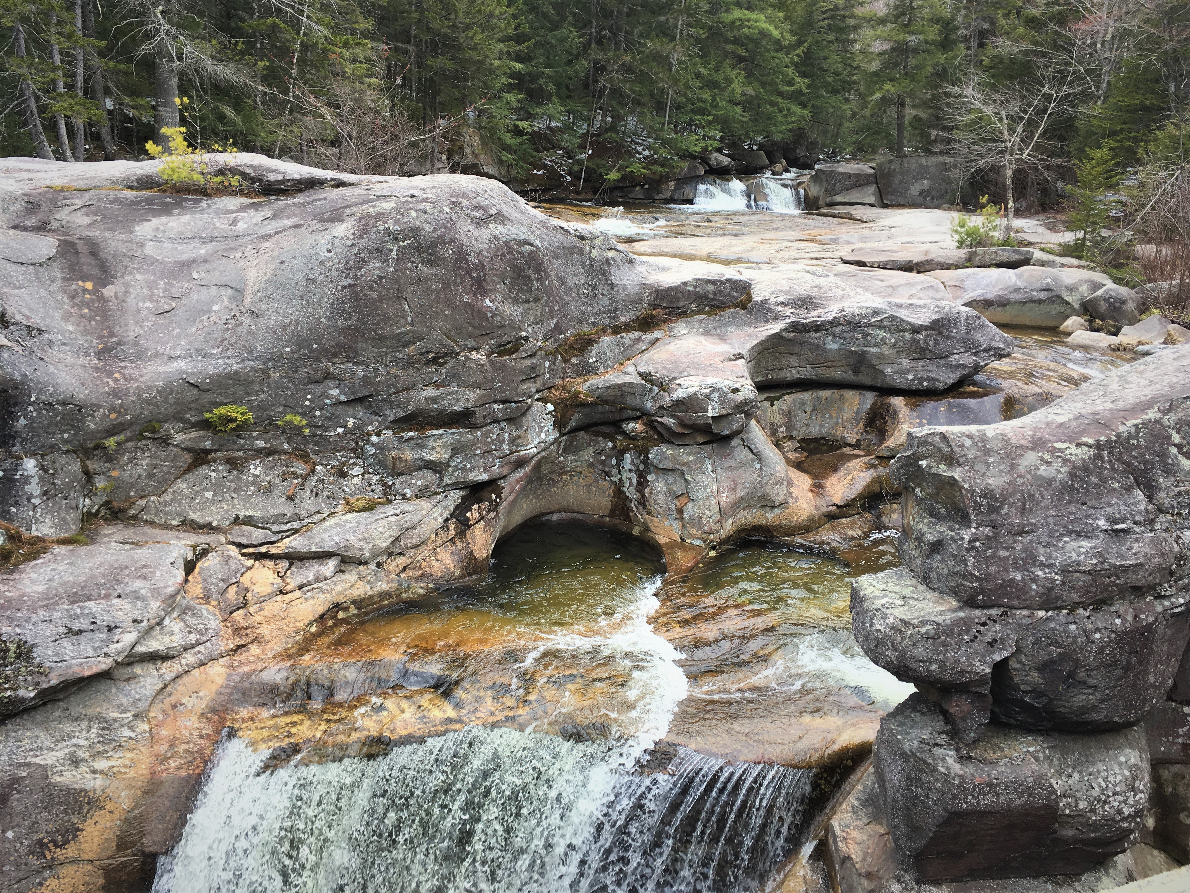
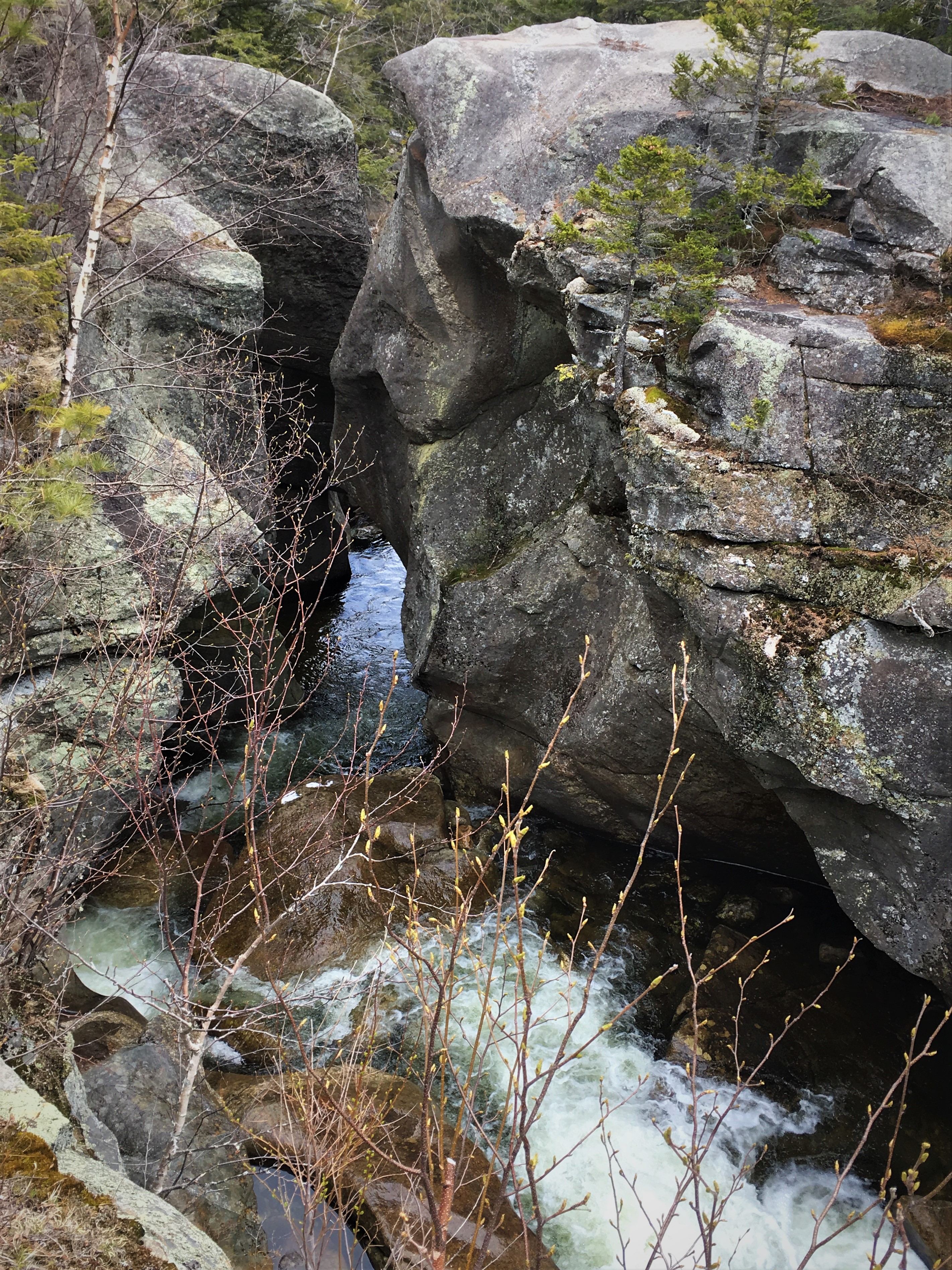
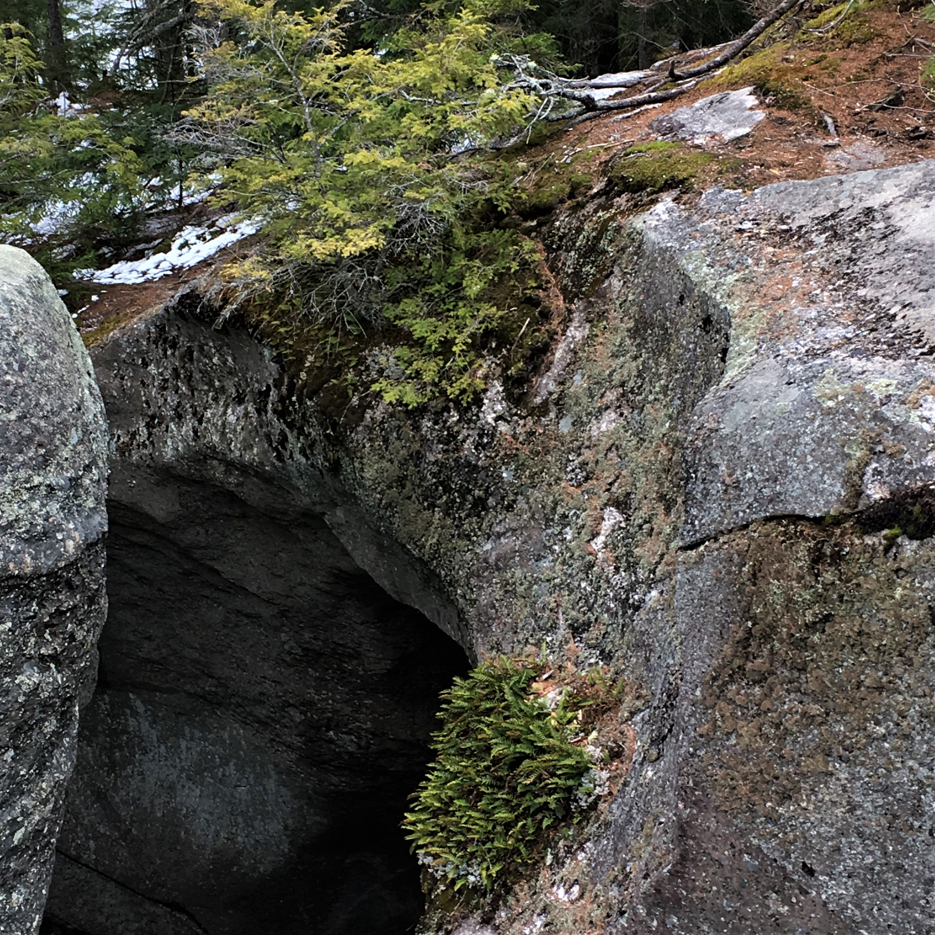
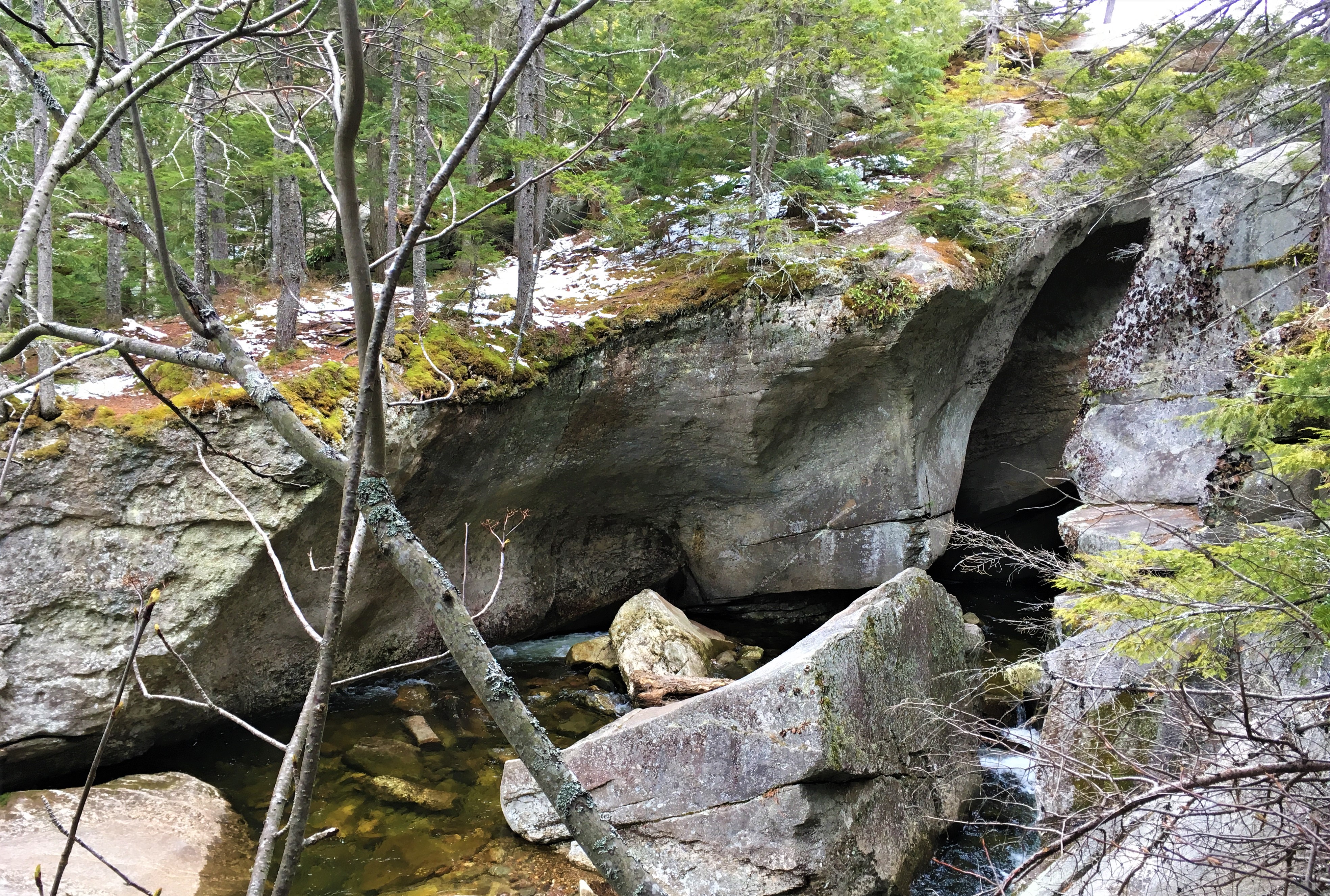
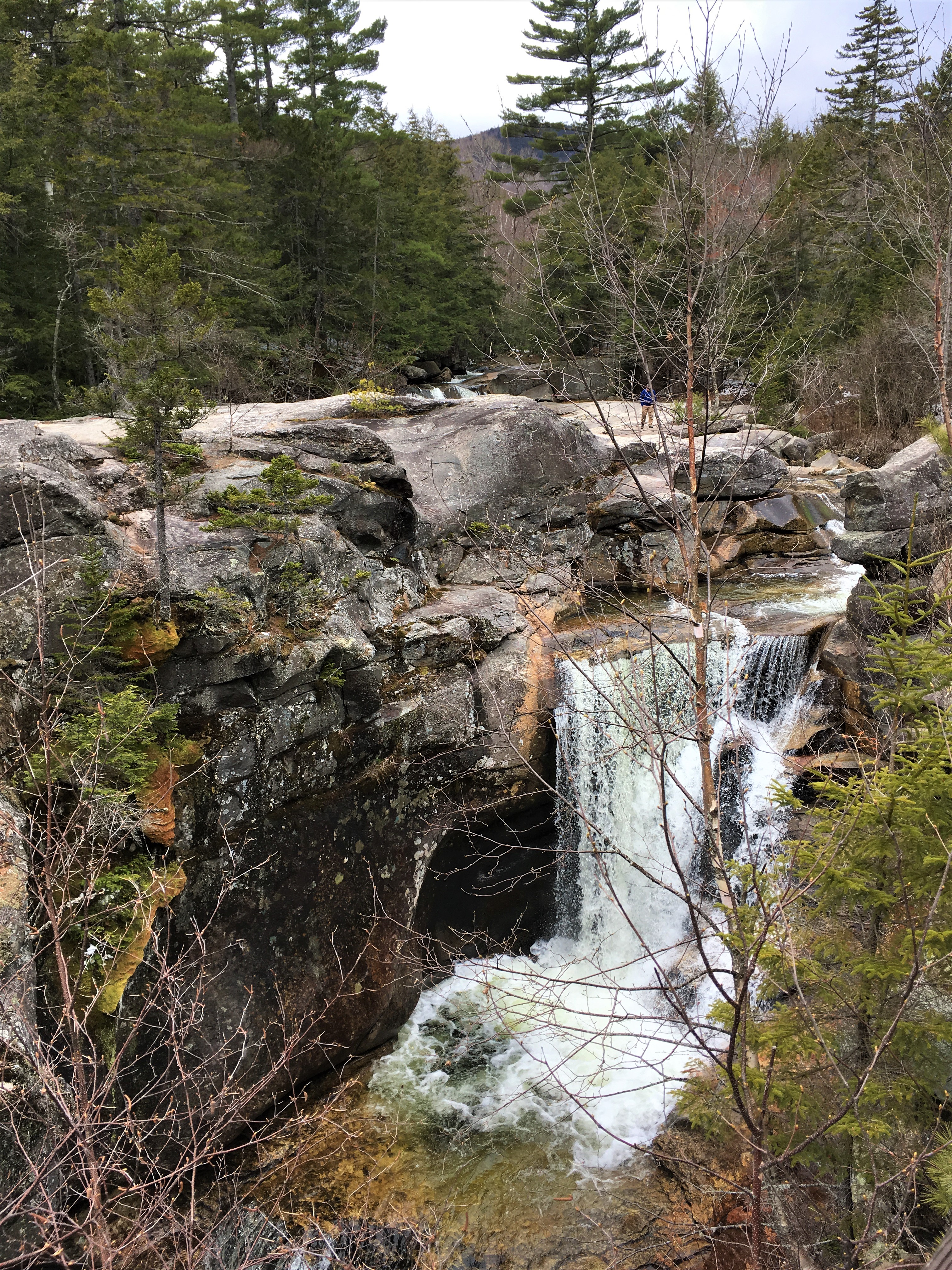
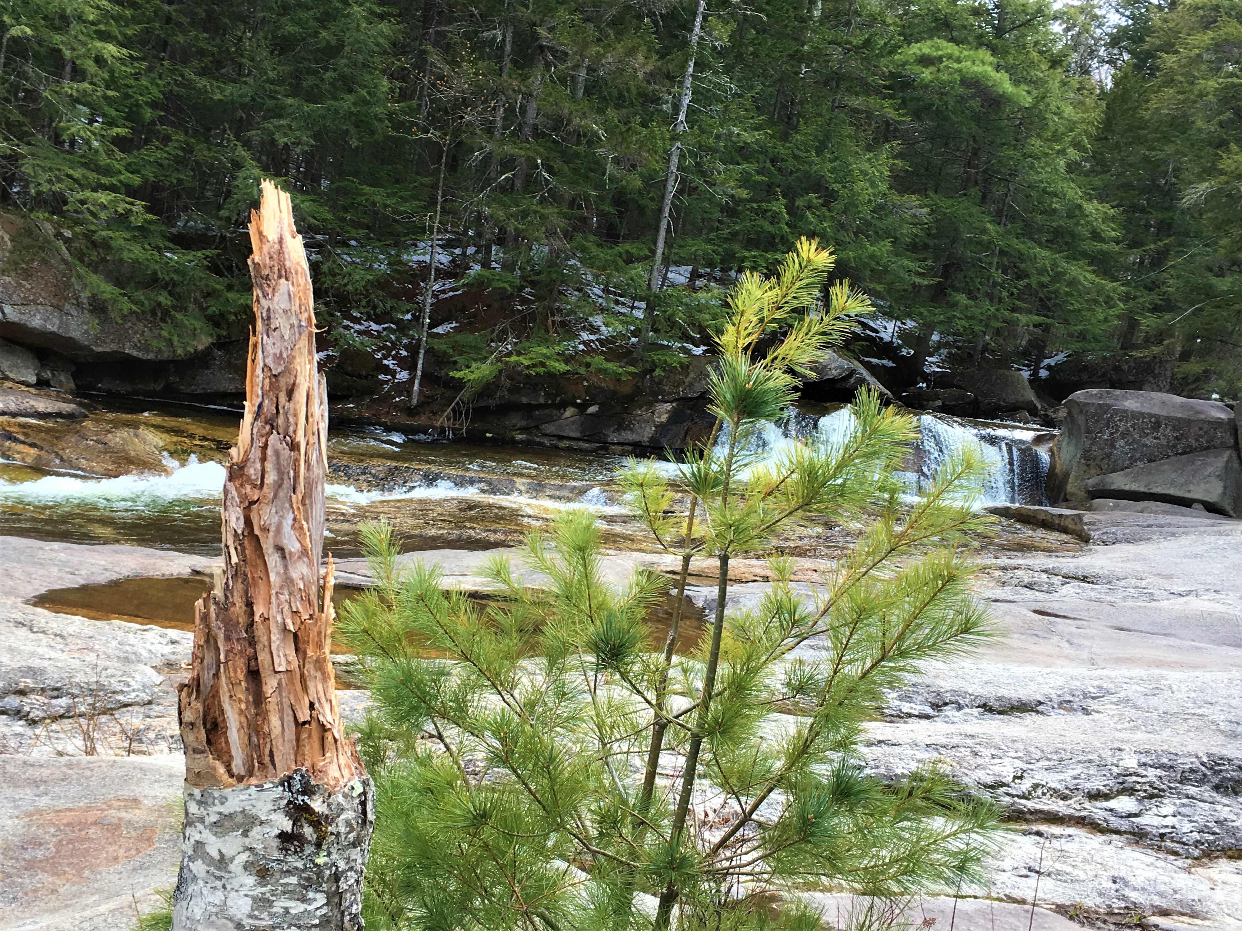
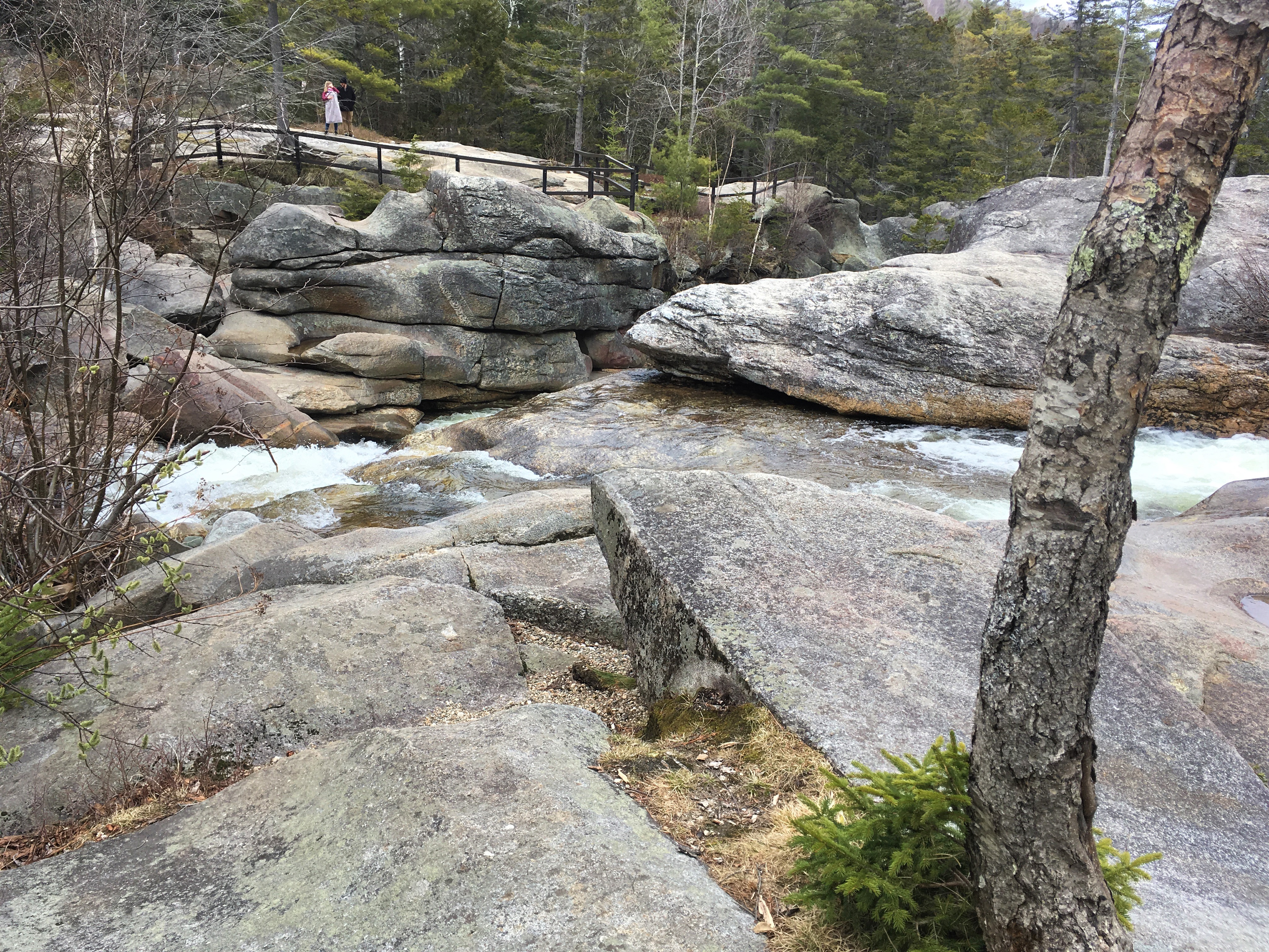
This, my parents tell me, is only the less impressive upper falls. The real Screw Auger Falls were farther down the Bear River, but confronted with a combination of snowmelt, mud, and the snow and ice from the night before, we decided we weren’t actually comfortable going all the way down the gorge to the biggest falls, leaving that for another visit.
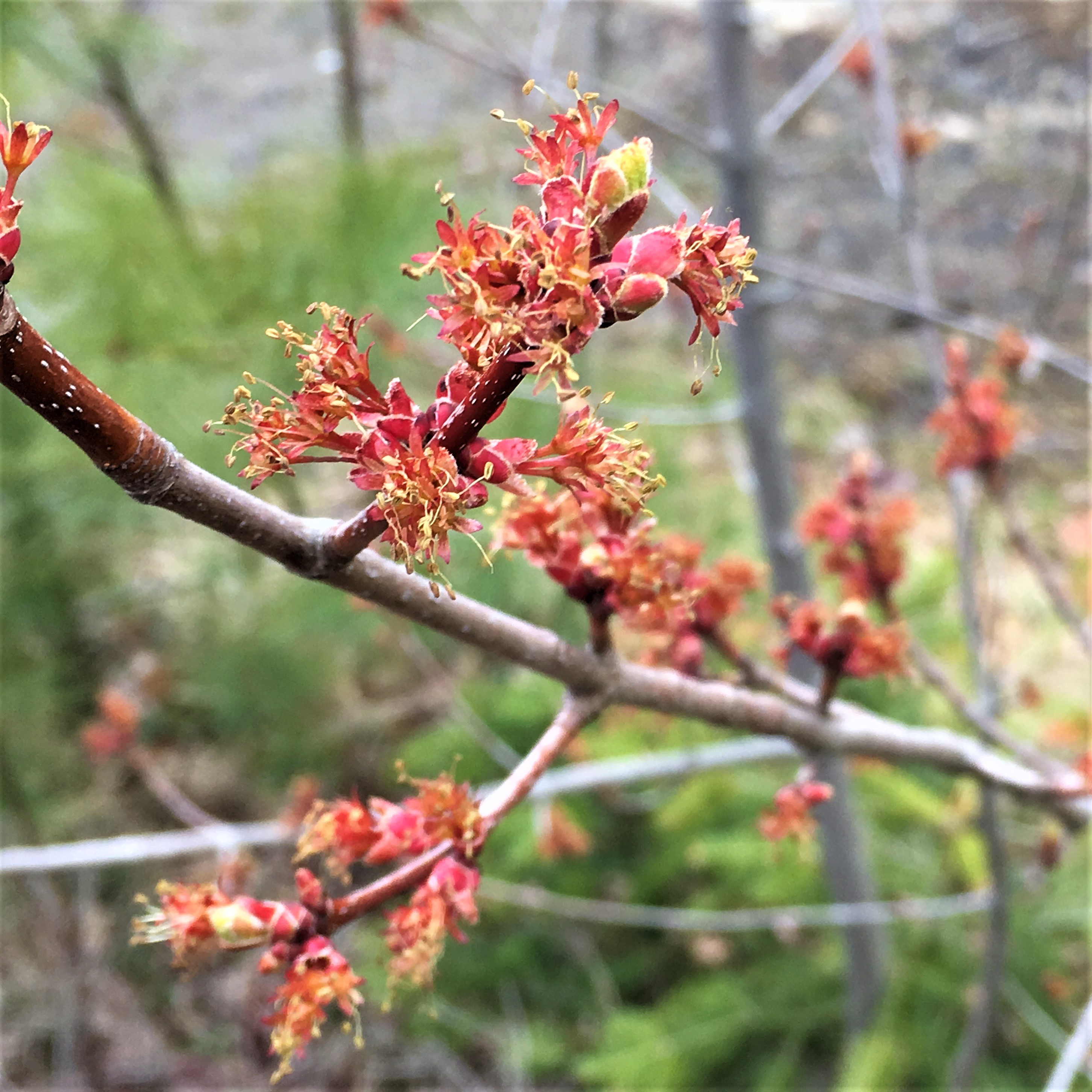
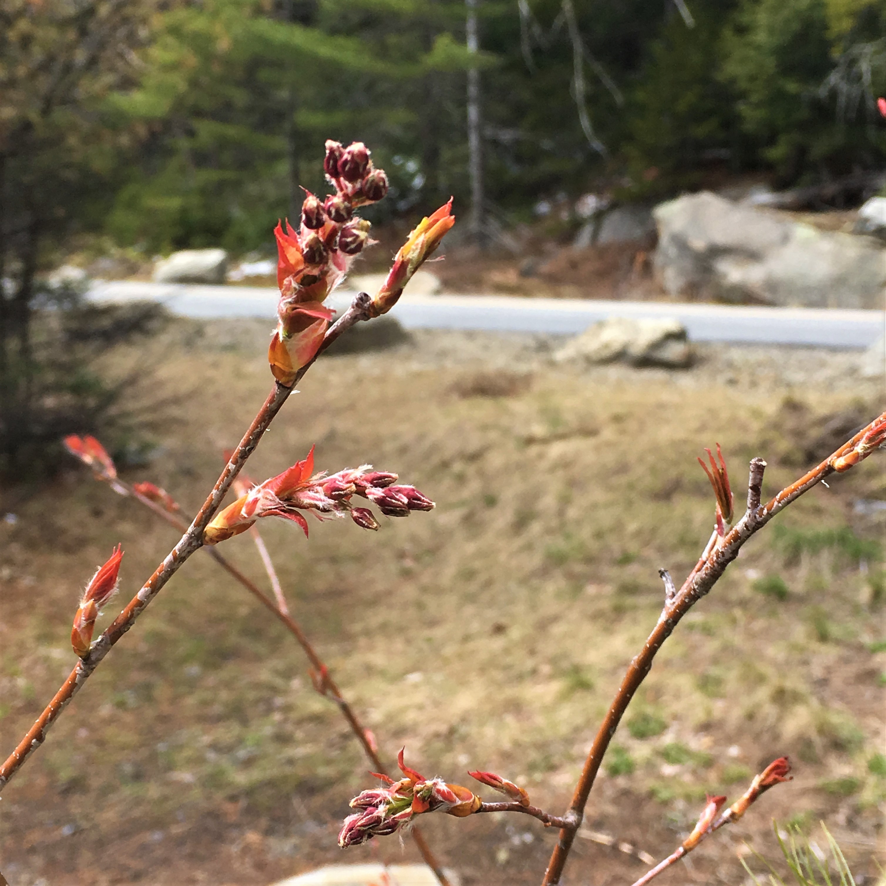
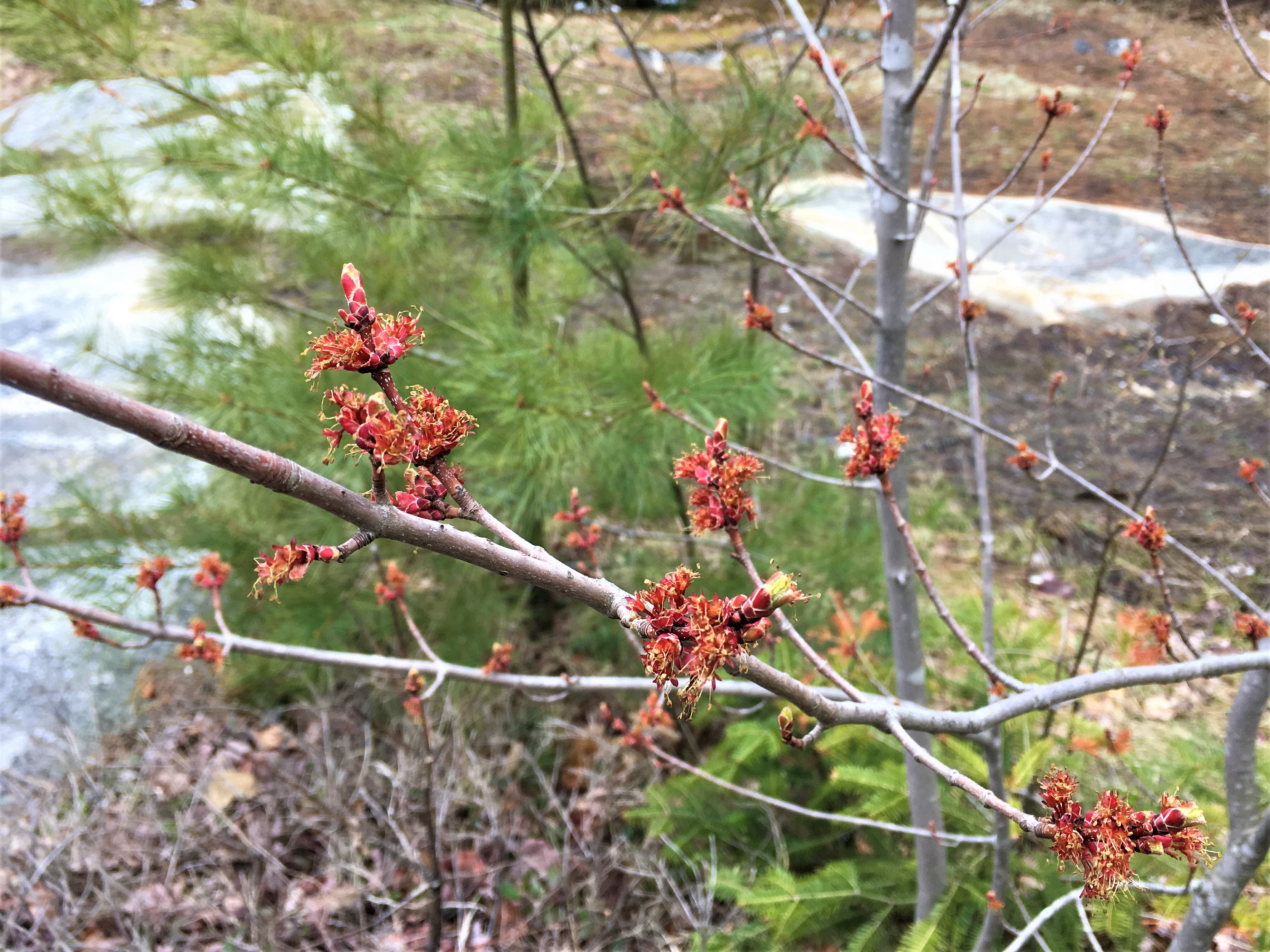
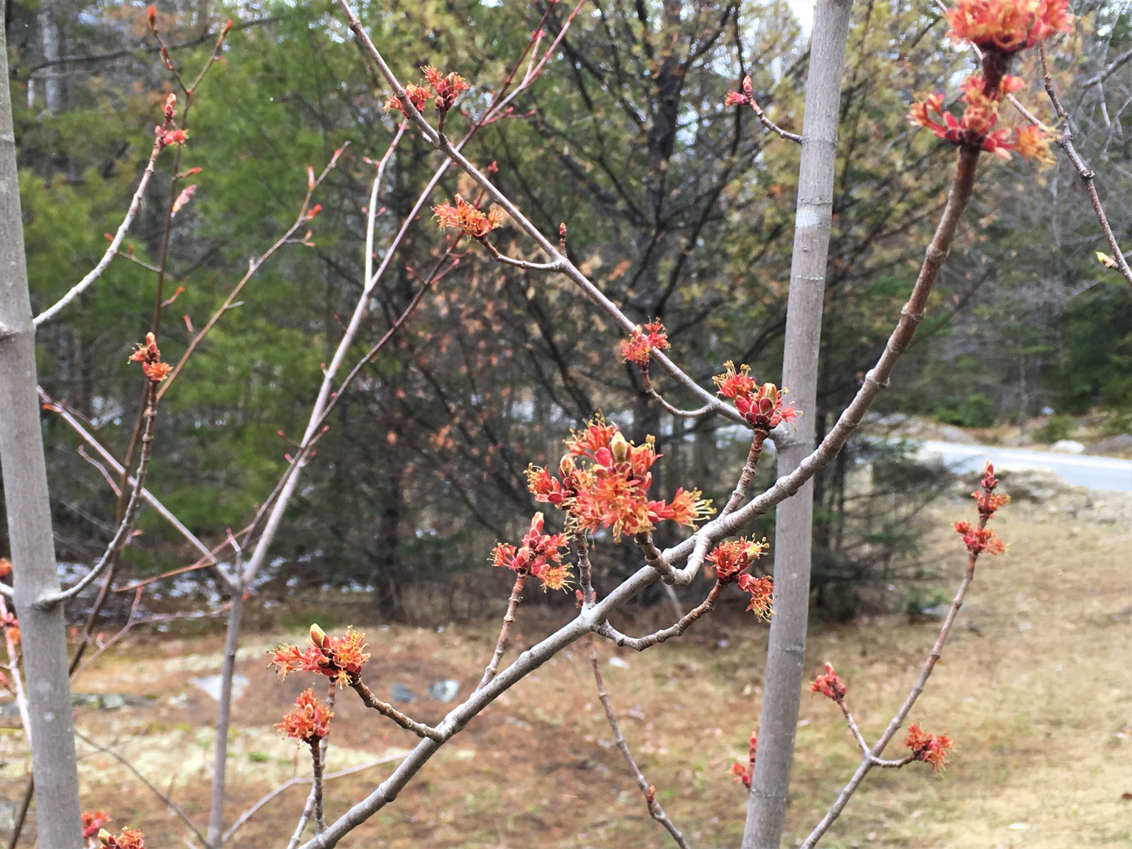
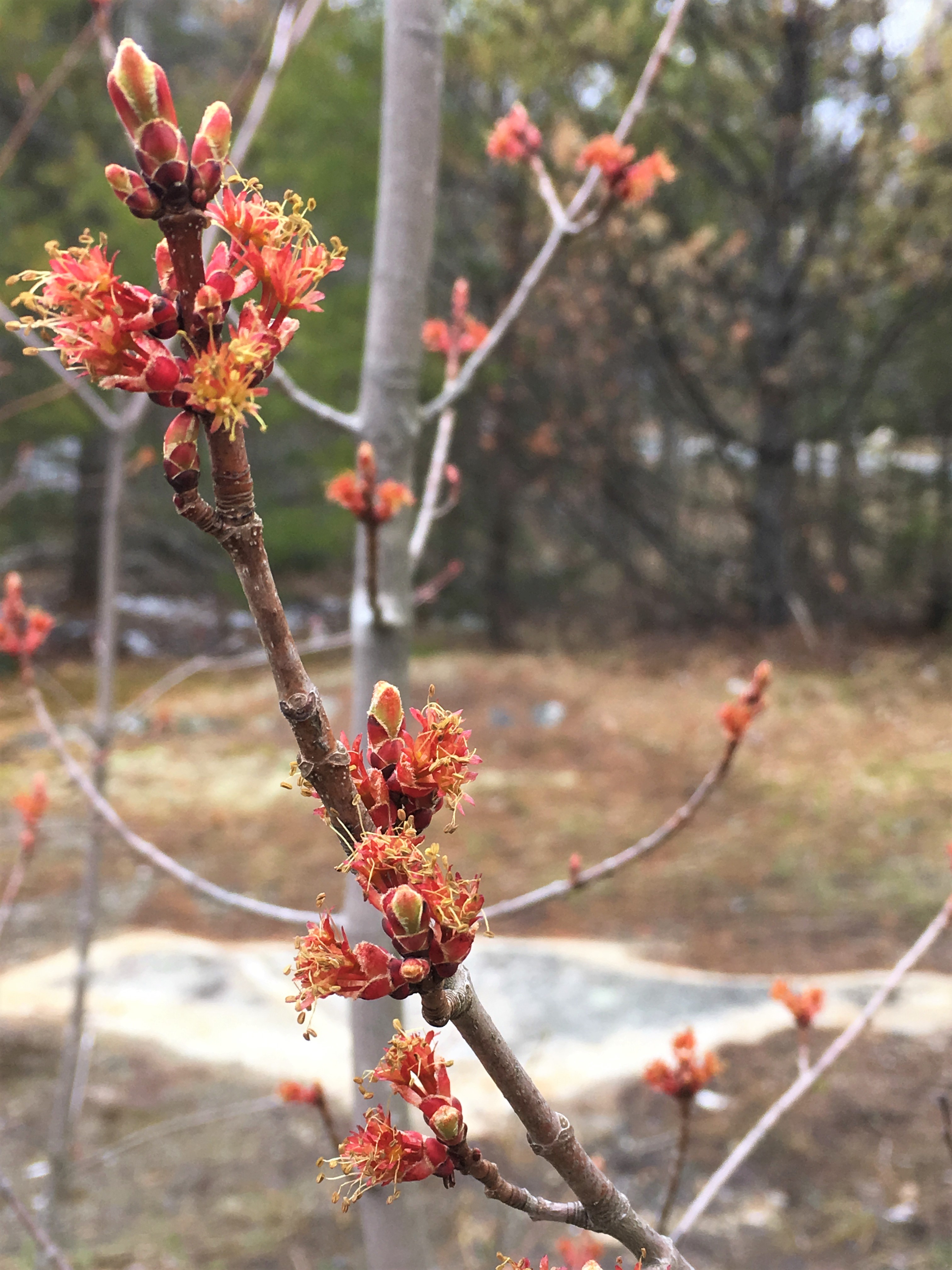
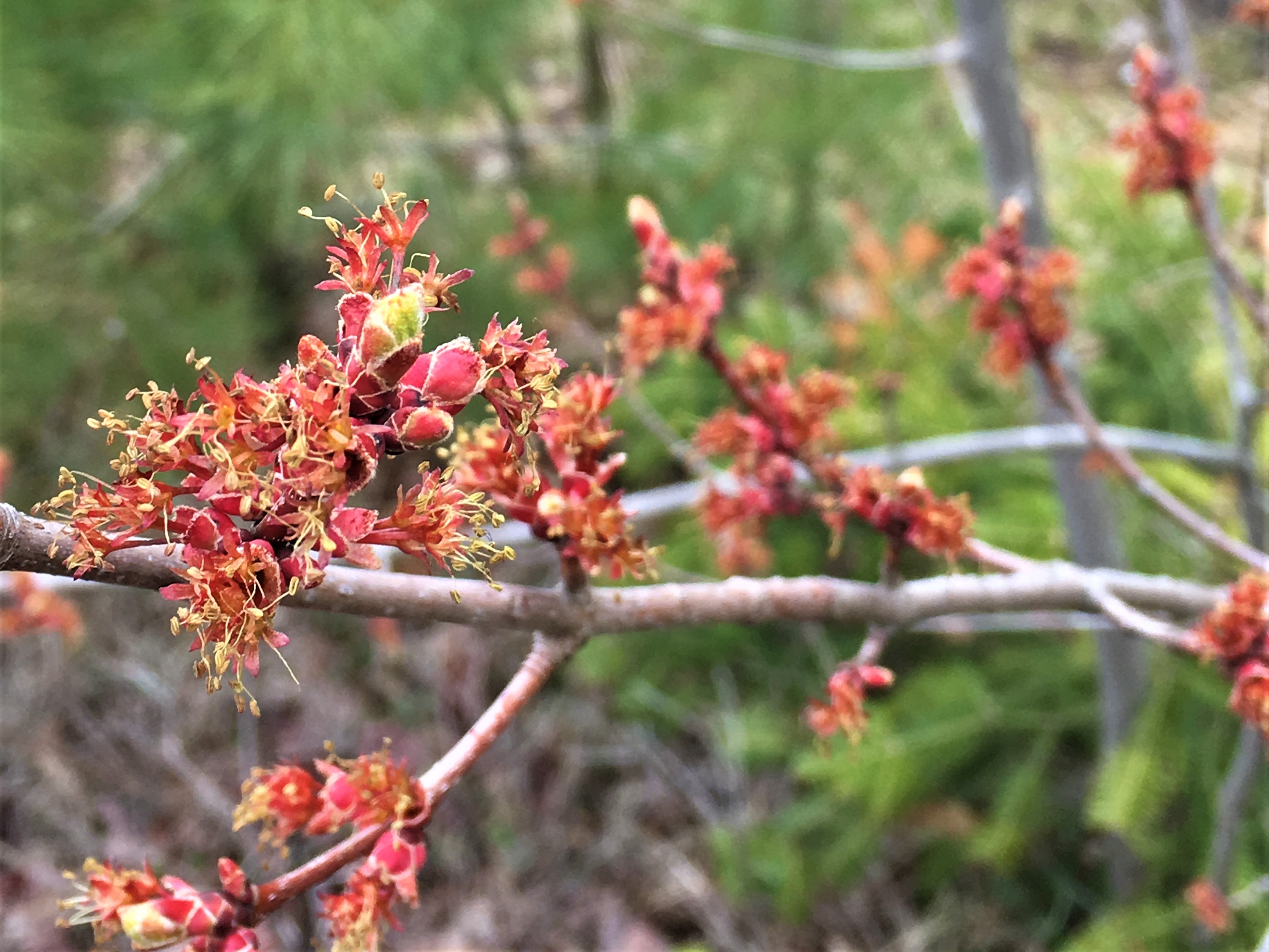
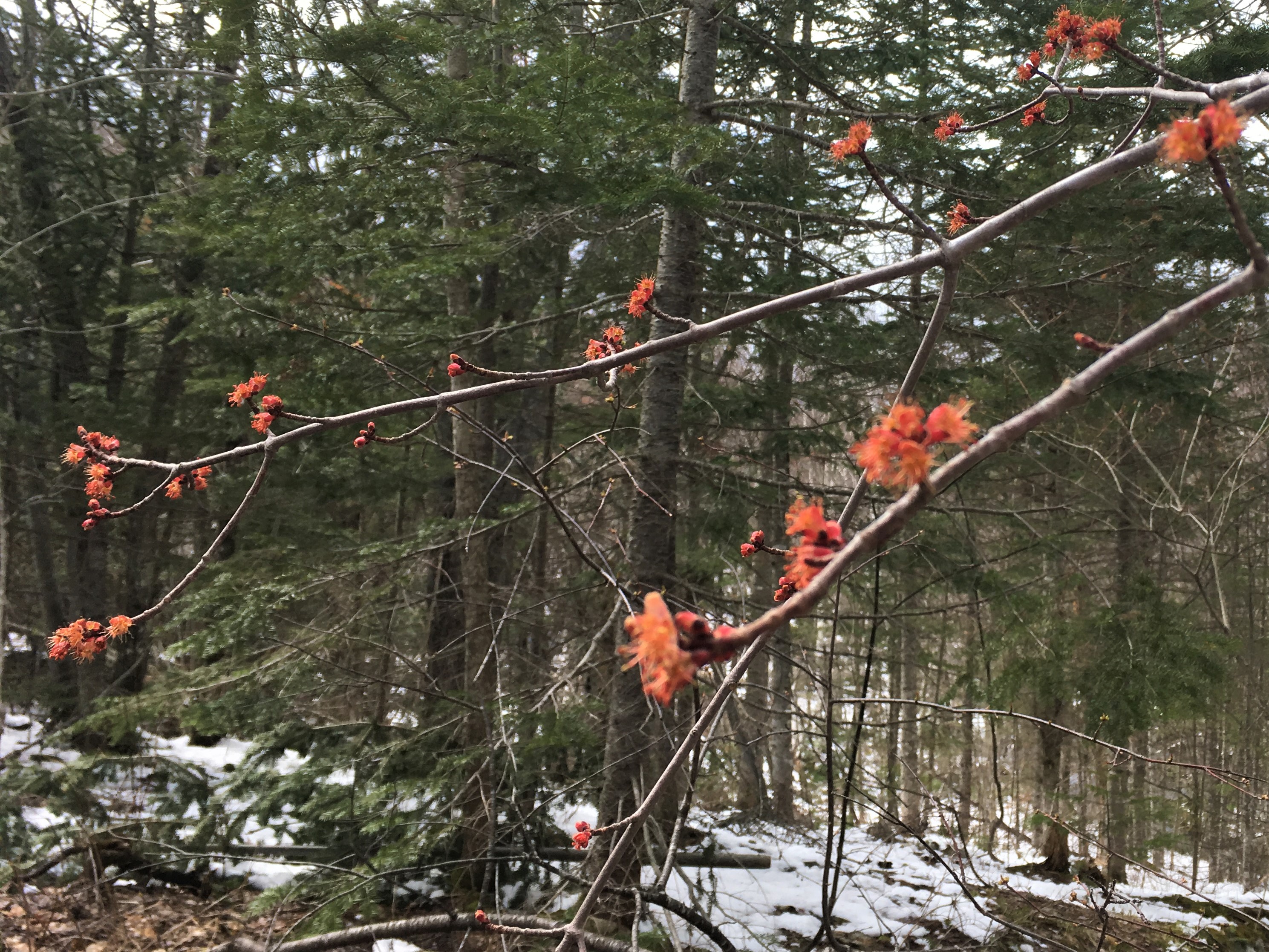
On our way back to the car, I may have gone a little hard on the maple blossom photos, but I’d been looking for a couple weeks for a maple that wasn’t so tall that I was taking pictures of maple stamens a dozen feet over my head.

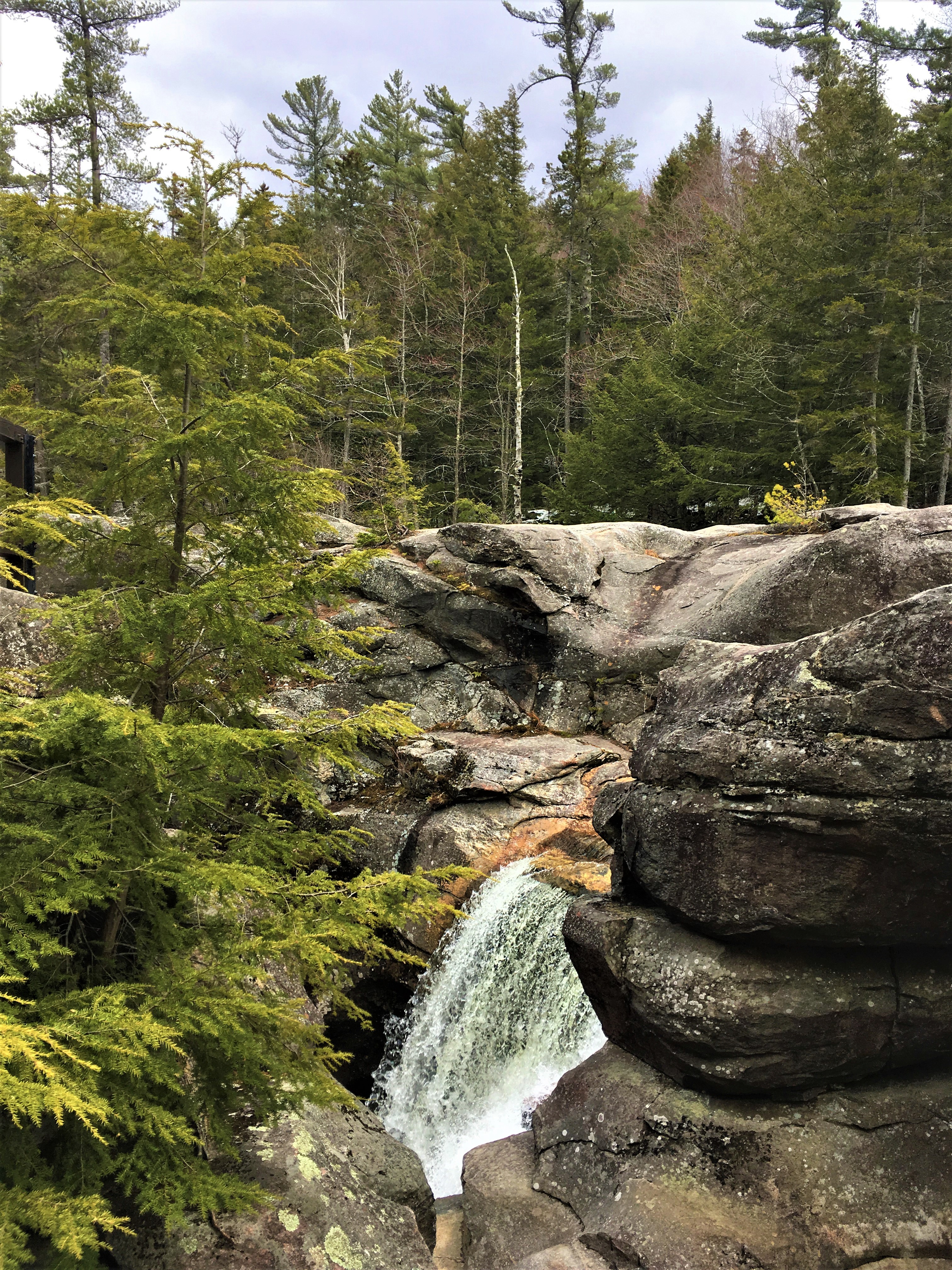
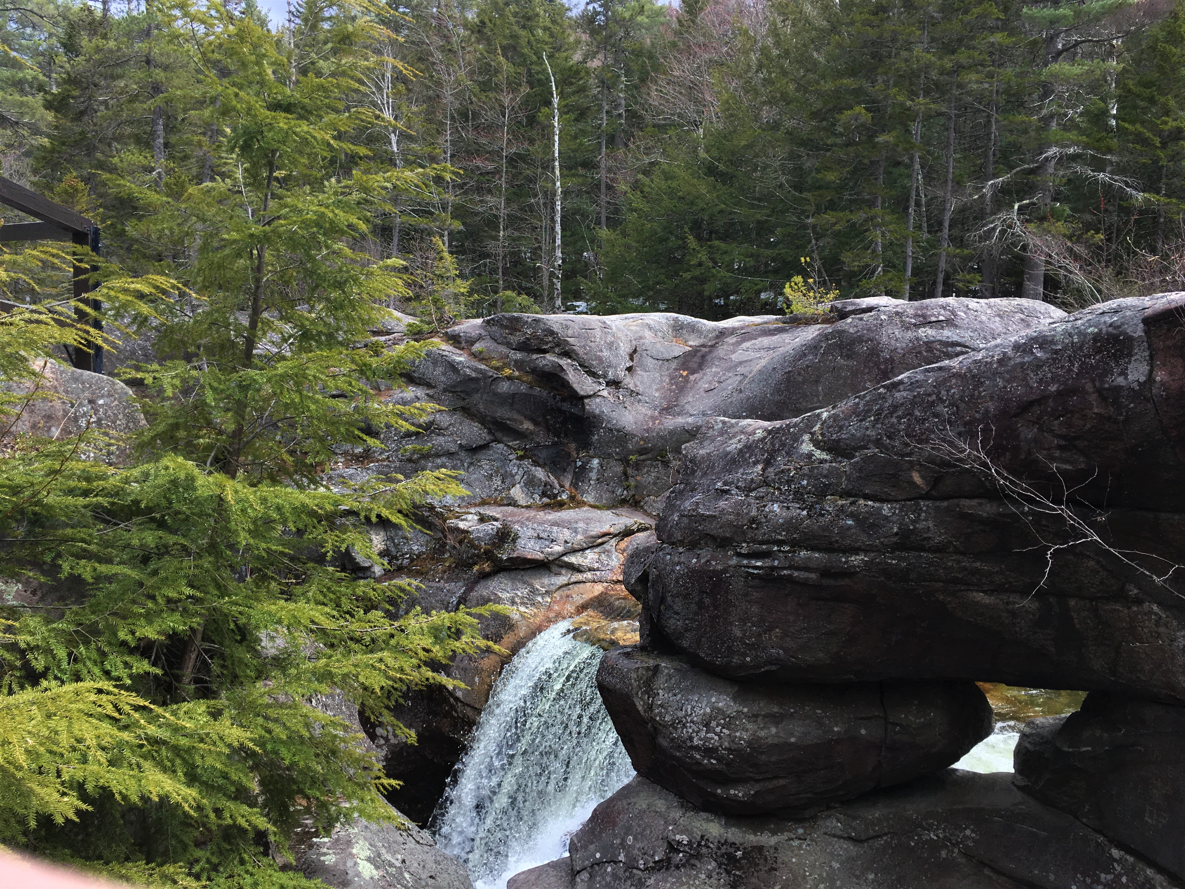
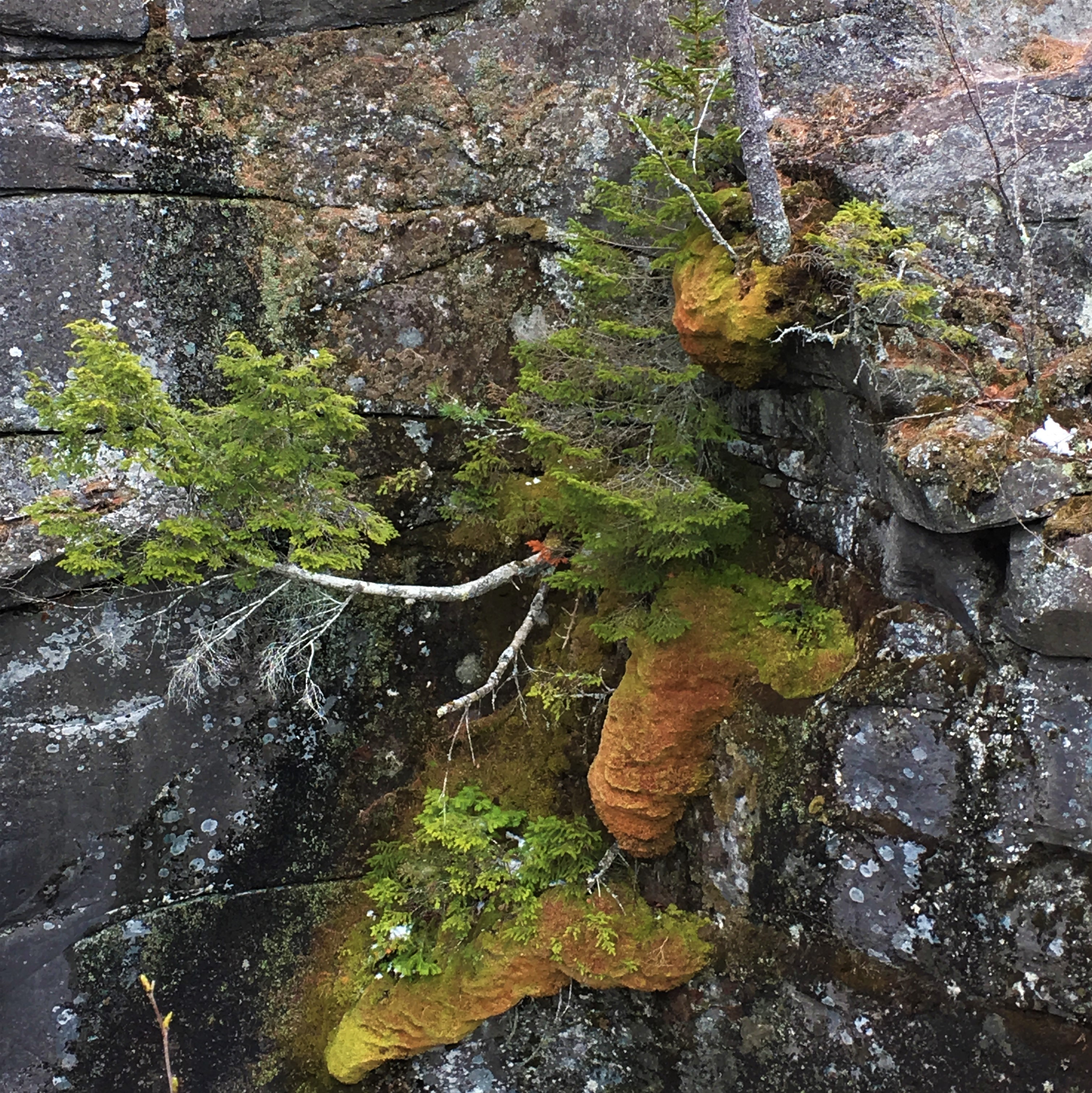
Mother Walker Falls
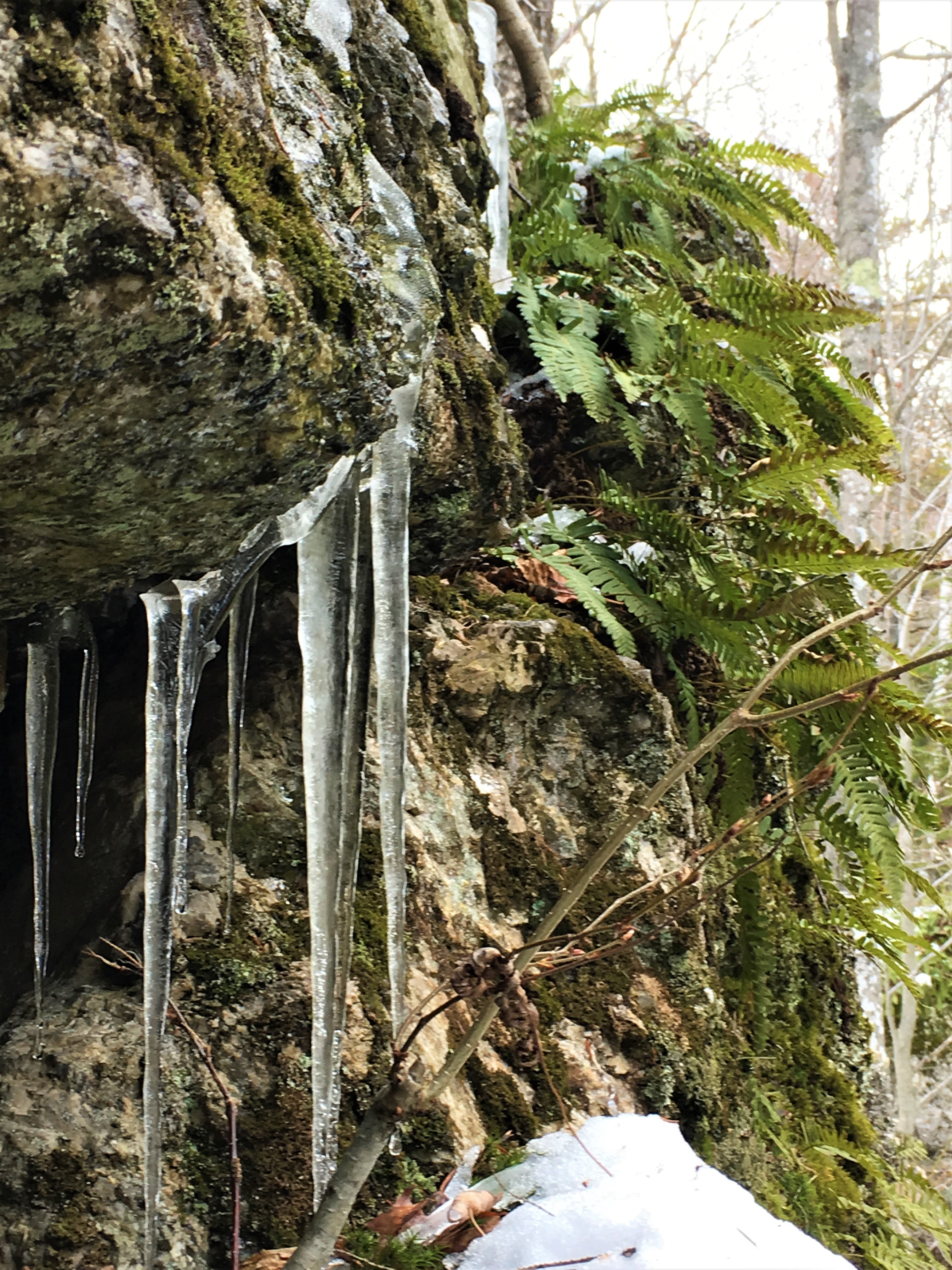
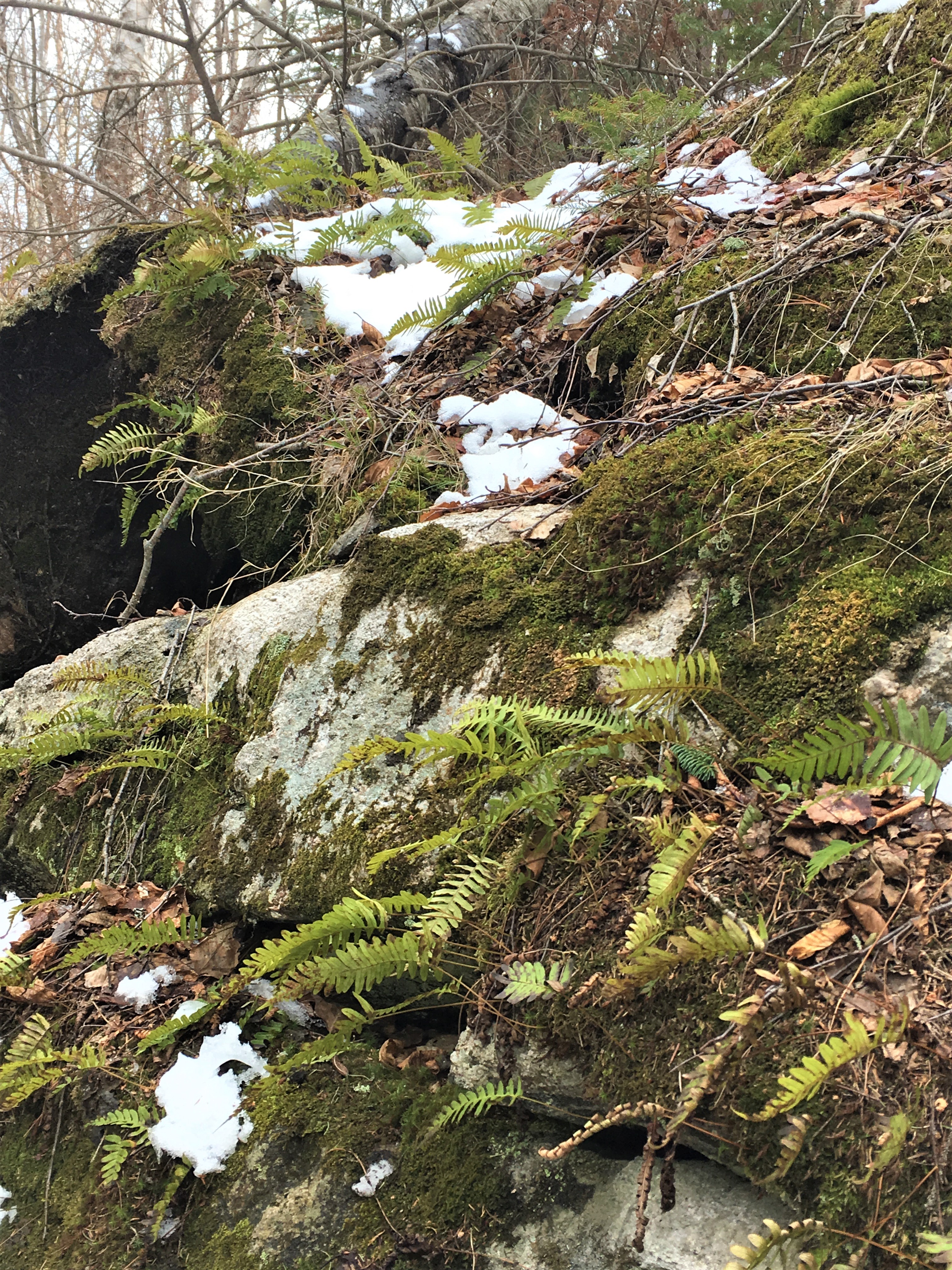
A short jig up the road is another pull-off and pair of trails known as Mother Walker Falls. We decided not to continue very far to the left-hand side of this turn-off to see the falls, because we were pretty sure we didn’t want to navigate these icy stairs, but I was a little sad that we couldn’t get closer to what looked from a distance like some really cool icicle formations!
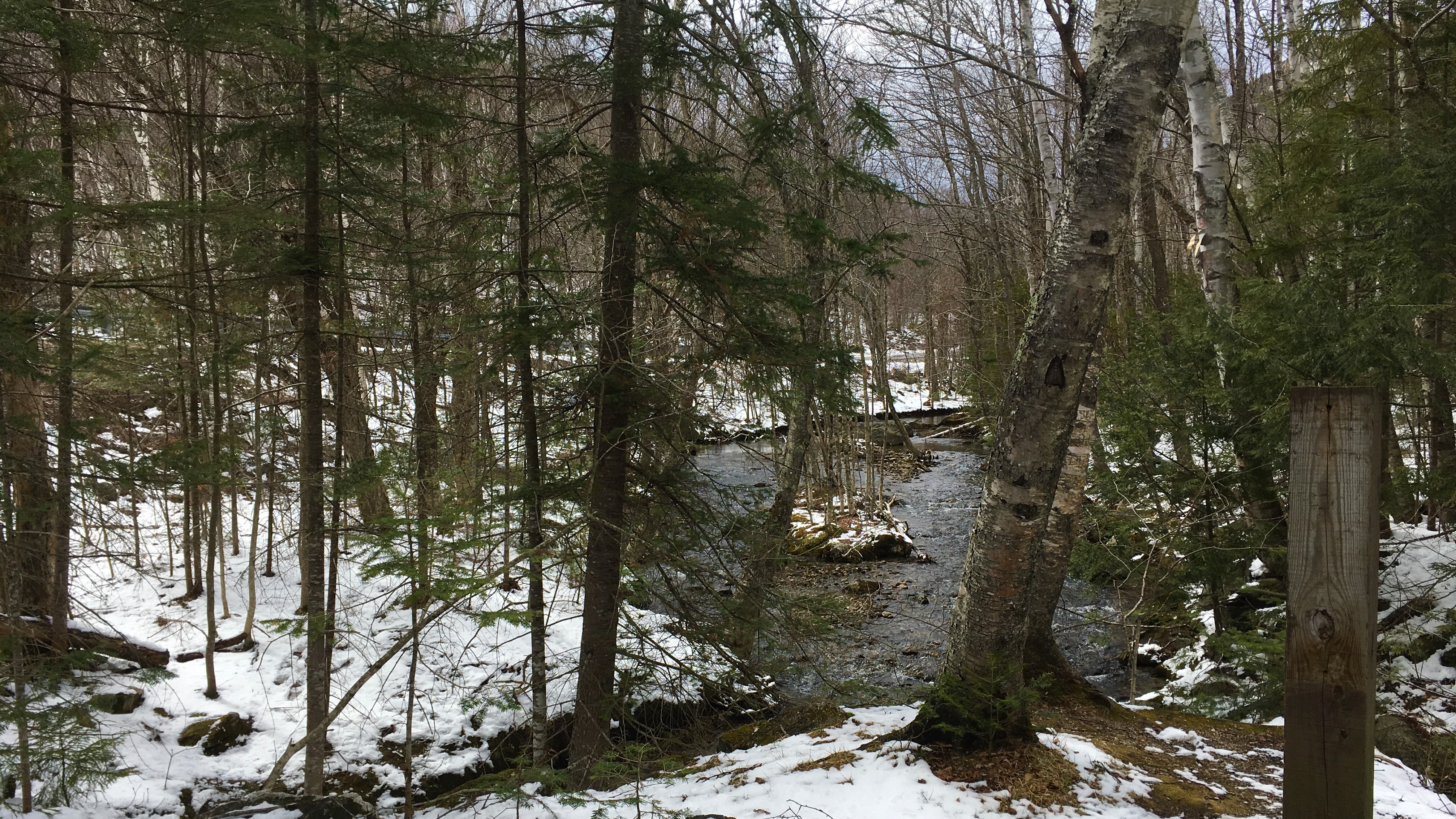
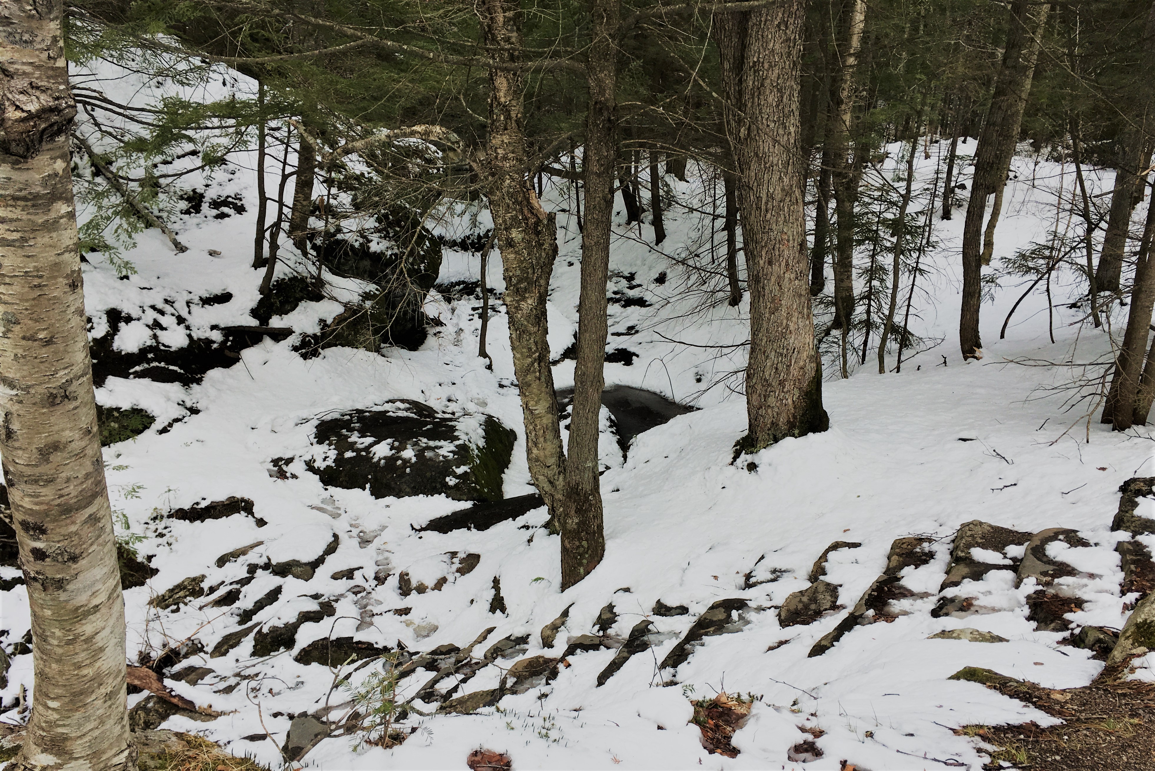
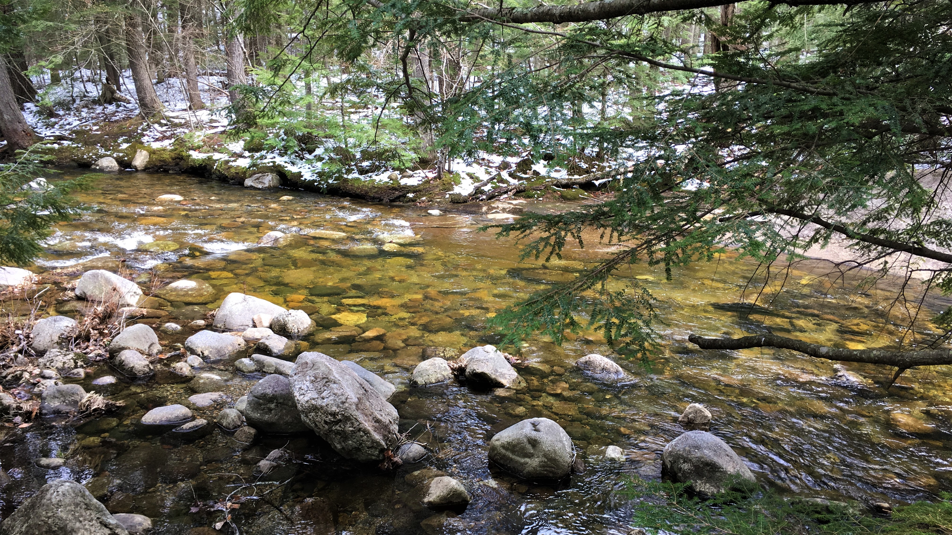
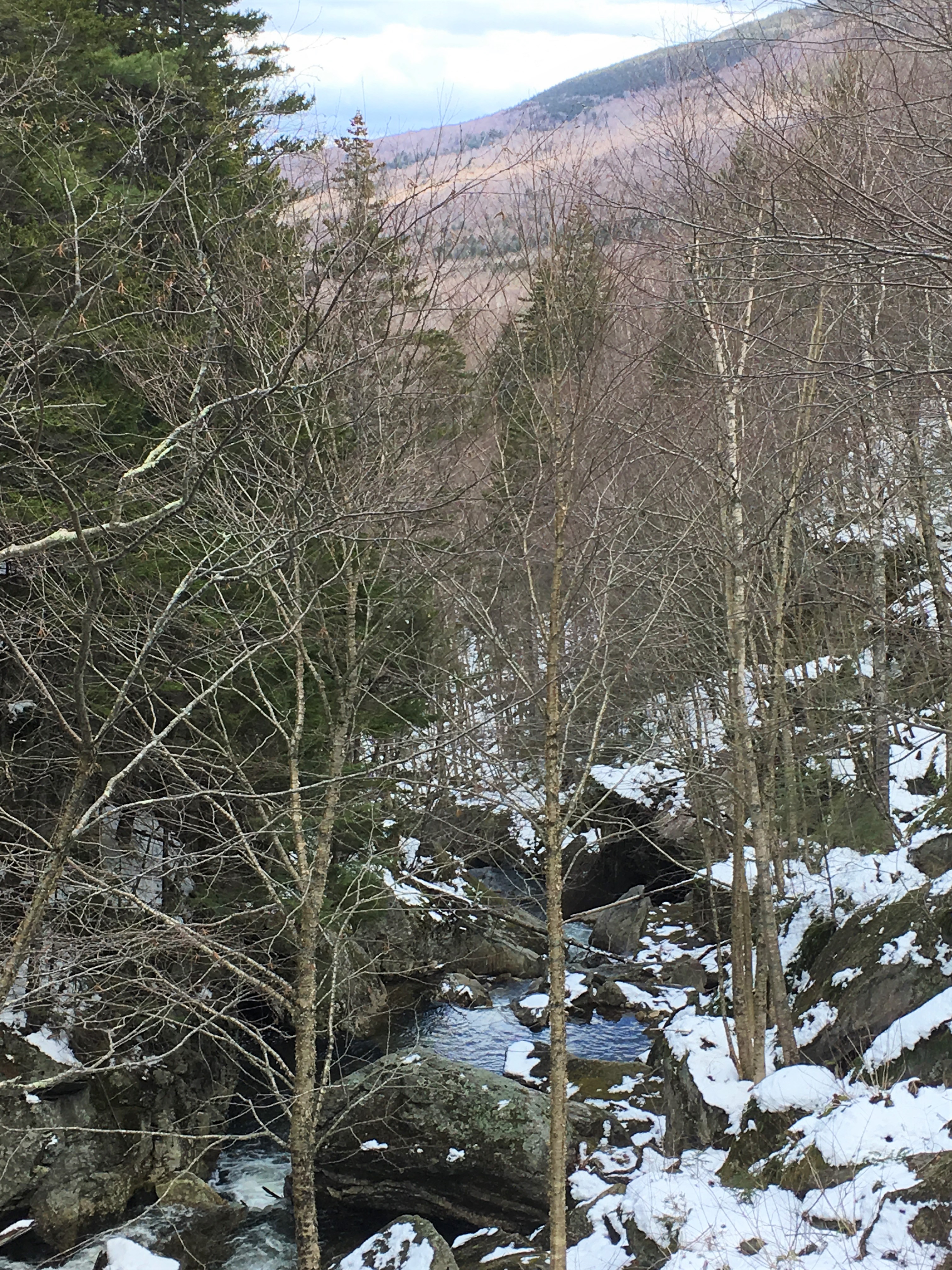
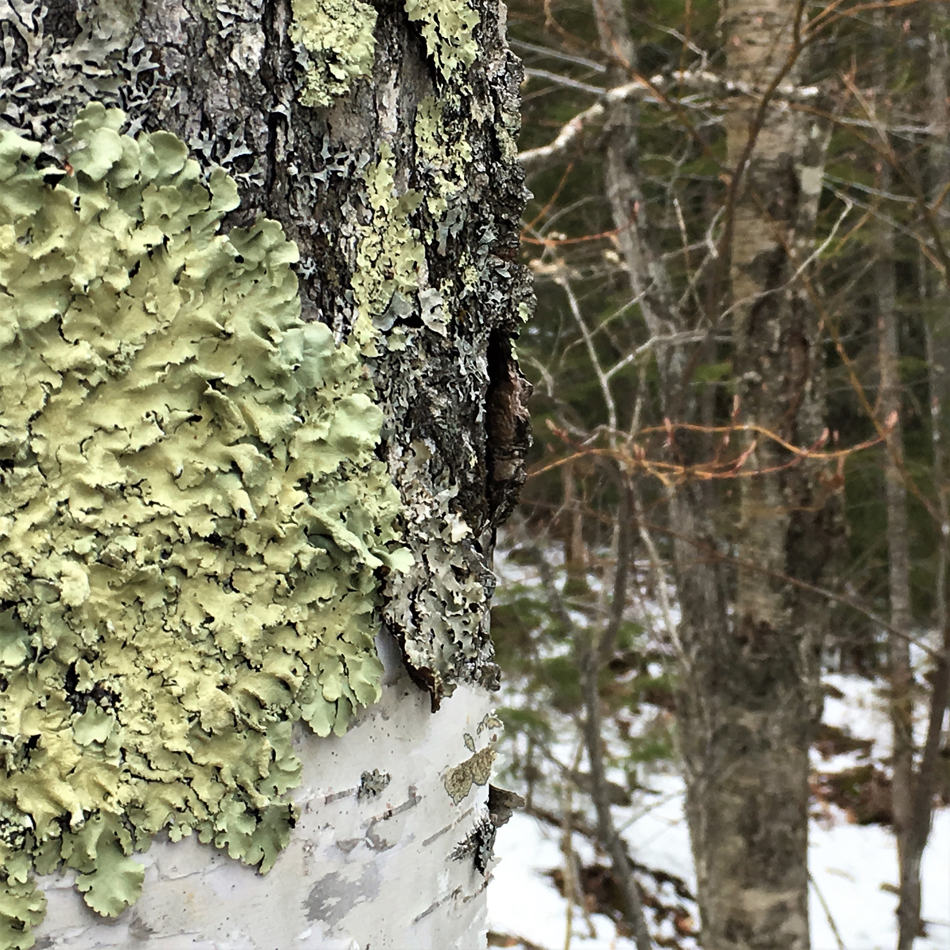
The trail in the other direction, while very short, seemed slightly less treacherous, and revealed some lovely views down the valley carved by the stream that feeds Mother Walker Falls, as well as some close encounters with icicles, ferns, mosses and lichens.


Appalachian Trail Crossing
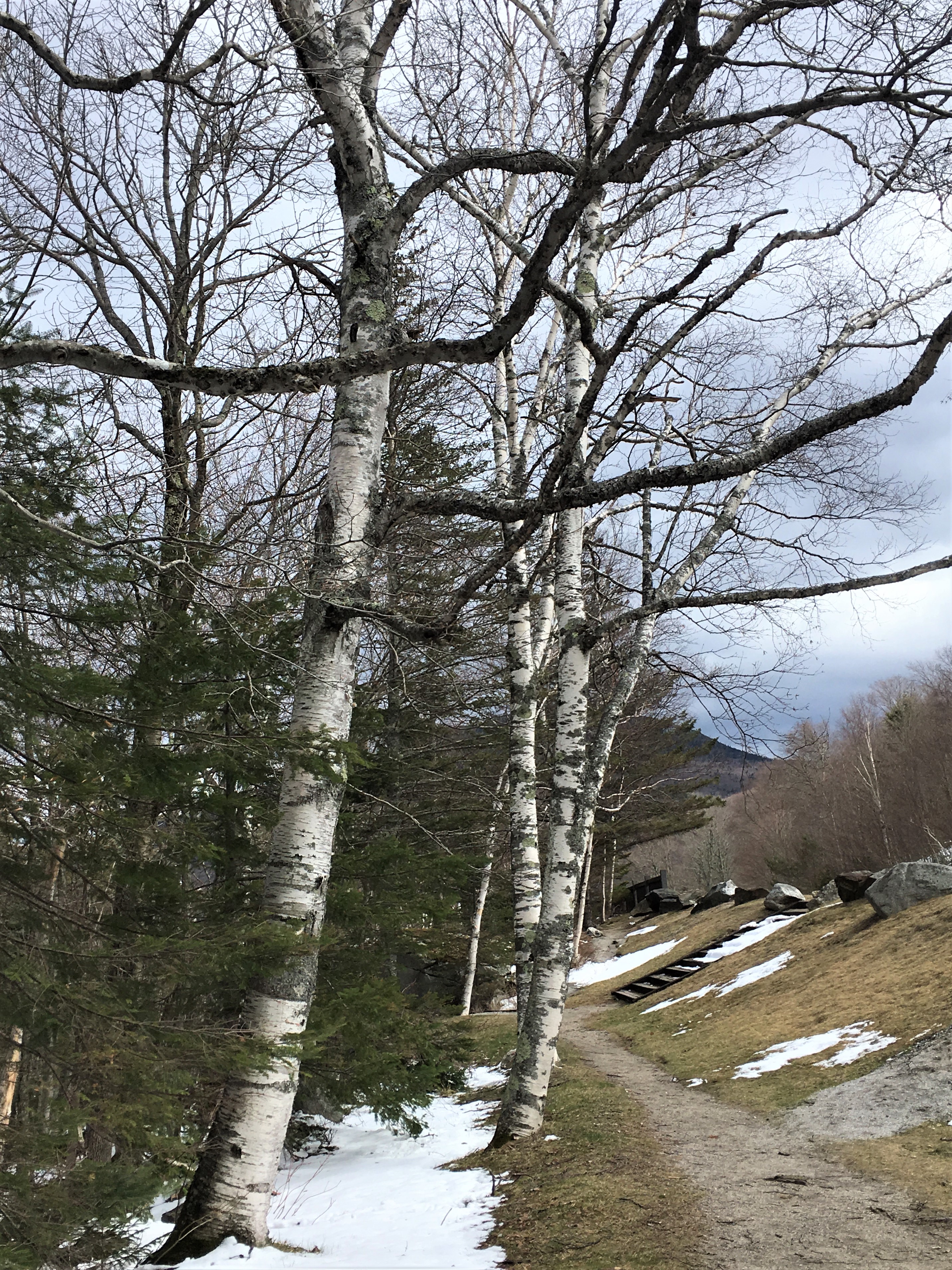
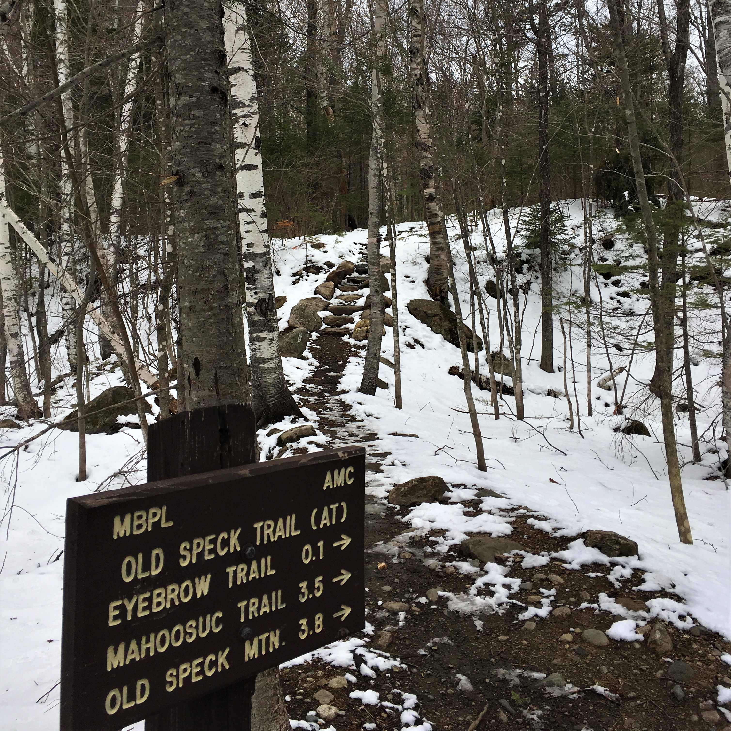
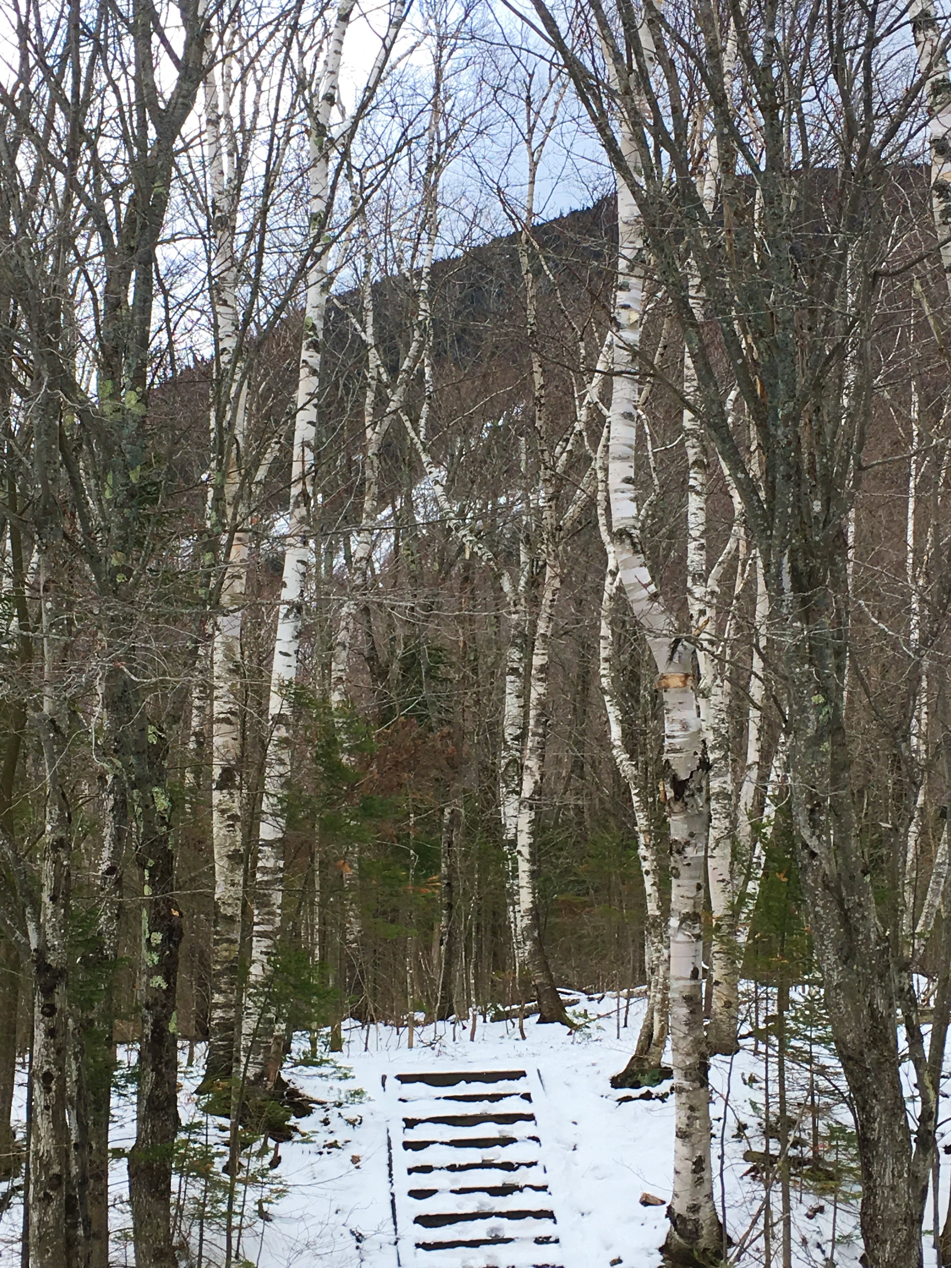
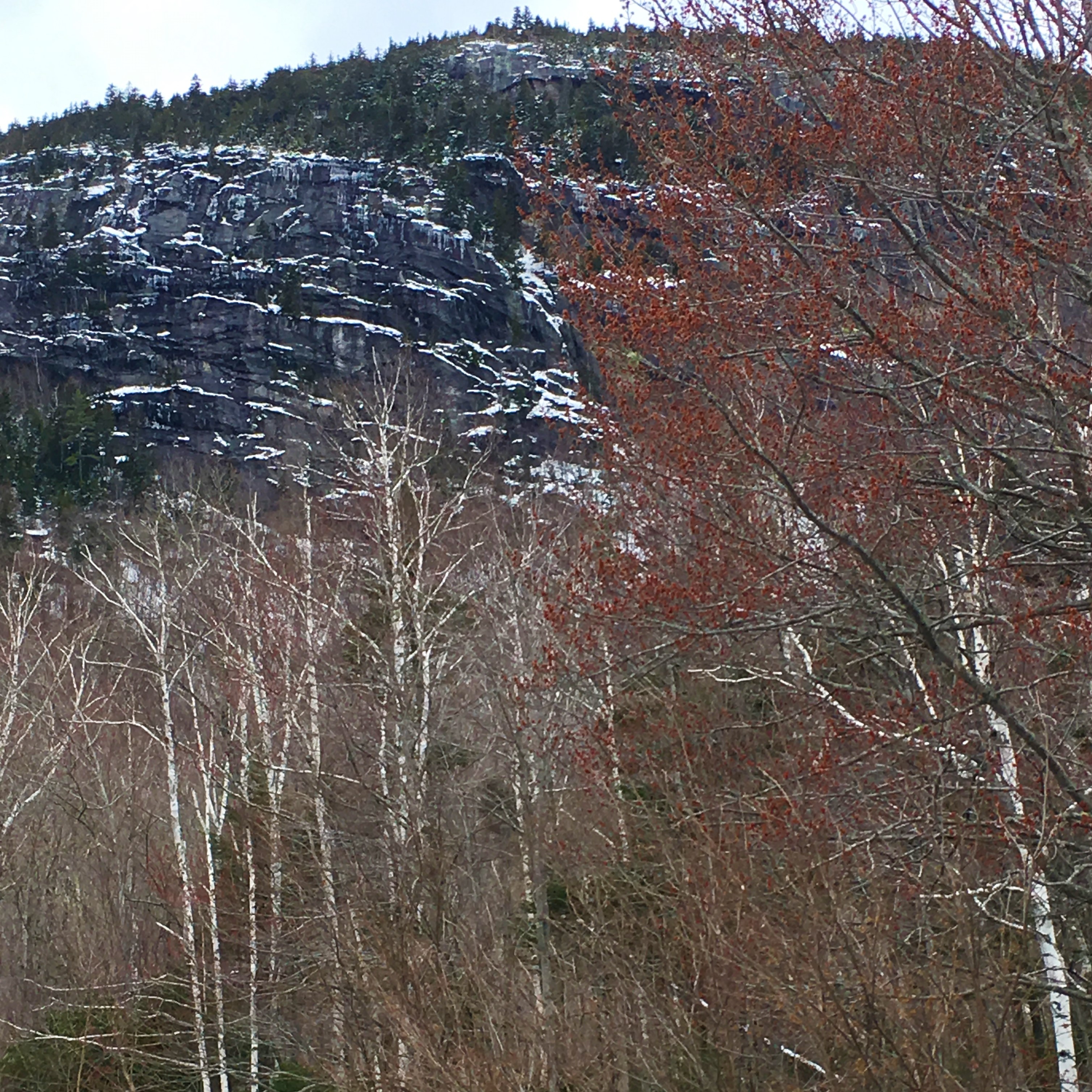
The third and final turnout in Grafton Notch State Park is where the Appalachian Trail crosses Rte. 26 at the foot of Old Speck Mountain. It was inching towards dinner time when we reached the AT crossing, but I had hiked several middle sections of the trail as a Cadette and Senior Girl Scout, and my father and brothers had hiked several longer sections as Boy Scouts, including in my father’s case some of the more northern portions. I wanted to at least see the trailhead, and as we turned in, I was quite enamored of the grove of tall, stately birches ringing the parking lot on three sides.

Nansen Ski Jump
We decided to loop back through New Hampshire on Rte. 16, a beautiful ride along the broad Androscoggin River, swollen with the spring melt, but we didn’t stop.
Dad had been amused the week before by some research a friend of his had done into pandemic lockdown measures. Apparently, hiking for exercise is considered an essential activity in Maine, but not considered an essential activity by the state of New Hampshire. Furthermore, under Maine’s lockdown rules, if you’ve left the state for non-essential activity, you have to self-quarantine for fourteen days before re-entering Maine society. So, we joked, if we got out of the car in New Hampshire, it would be for non-essential activity, and we’d be stuck in quarantine when we got home.
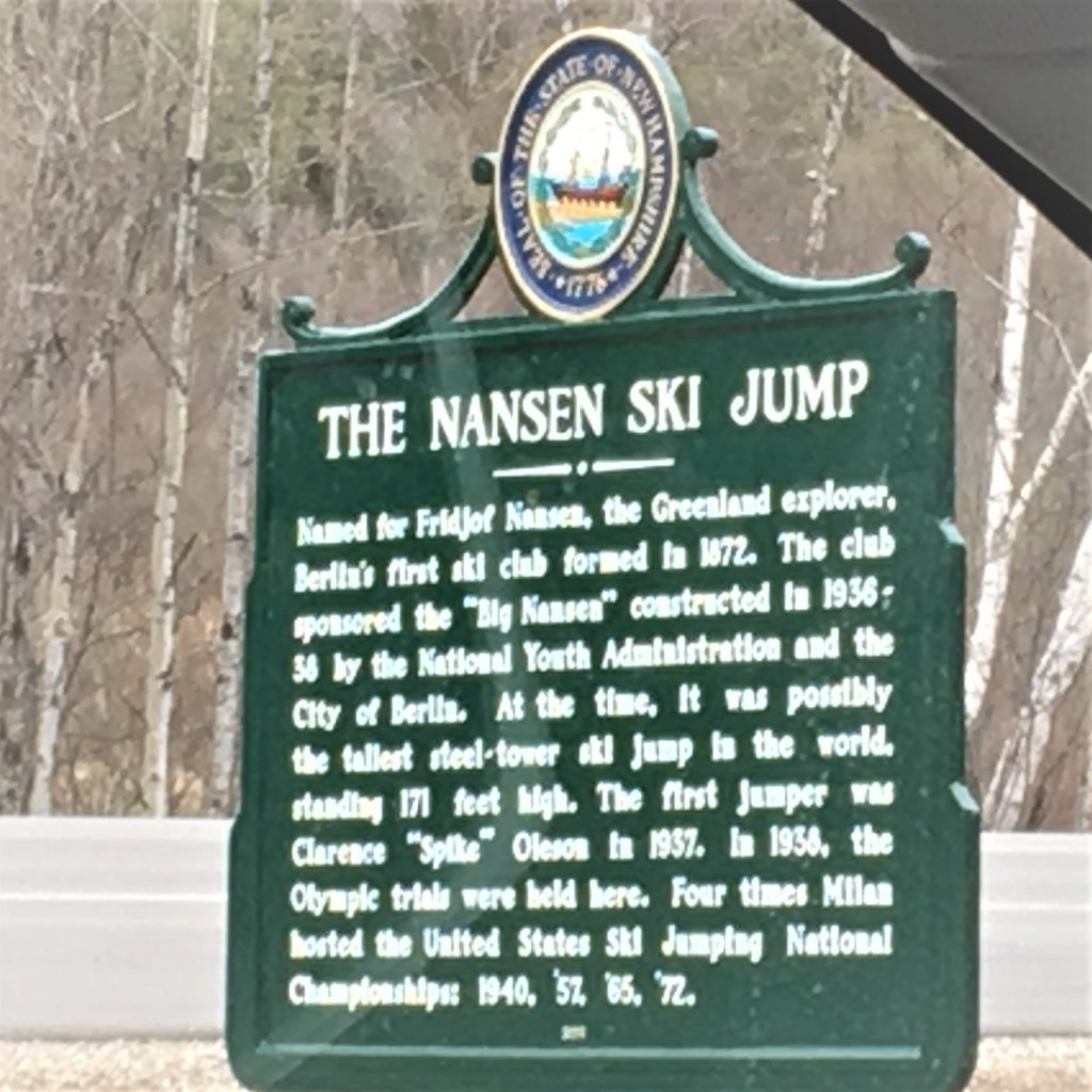
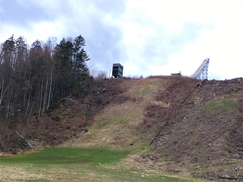
We did, however, stop and roll down the windows for a shot at the Nansen Ski Jump, which for decades was the tallest ski jump in the eastern United States, and hosted four U.S. Ski Jumping National Championships, as well as the 1936 Olympic trials. It’s been increasingly derelict since it went out of use in 1985, but a new effort hopes to have it working again next year!
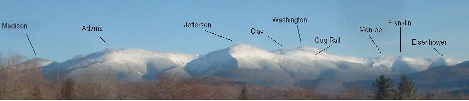
We continued our drive down through the Presidential Range of the White Mountains, Madison to Washington. As we drove past Wildcat Ski Area and the famous Mount Washington itself, I realized that though I have heard many stories about this mountain, which my father as a young man and my brother now love(d) to hike, I don’t think I’d every actually been there before. Depending how the rest of the season goes, maybe this could be the summer I finally take the famous Mount Washington Auto Road or, less likely, the cog railroad.
After a beautiful day of mountains, rivers and waterfalls, the last stretch of Rte. 16 through North Conway was sobering. This town I know well. It’s where my mother worked for a number of years at the L.L. Bean outlet, where my brother preferred to shop for climbing gear at EMS, a tourist town and outlet shopping destination on the edge of the White Mountains in sales-tax-free New Hampshire.
Usually, we would take back roads to avoid Rte. 16 through the center of town because it crawls at half the speed limit, jammed full with the cars of tourists and shoppers. Today, it was empty. The streets, the parking lots, the shuttered stores … it was a ghost town. And while, intellectually, we knew this would be the case, seeing it was something different. “I can’t believe,” my mother kept saying for the better part of our last hour in the car, “how few people there are, how few cars there are.”
